Image of US radar destroyed by Iran in Qatar is AI-generated
- Published on March 9, 2026 at 22:26
- 4 min read
- By Paula CABESCU, AFP Romania
- Translation and adaptation Gwen Roley, AFP Canada
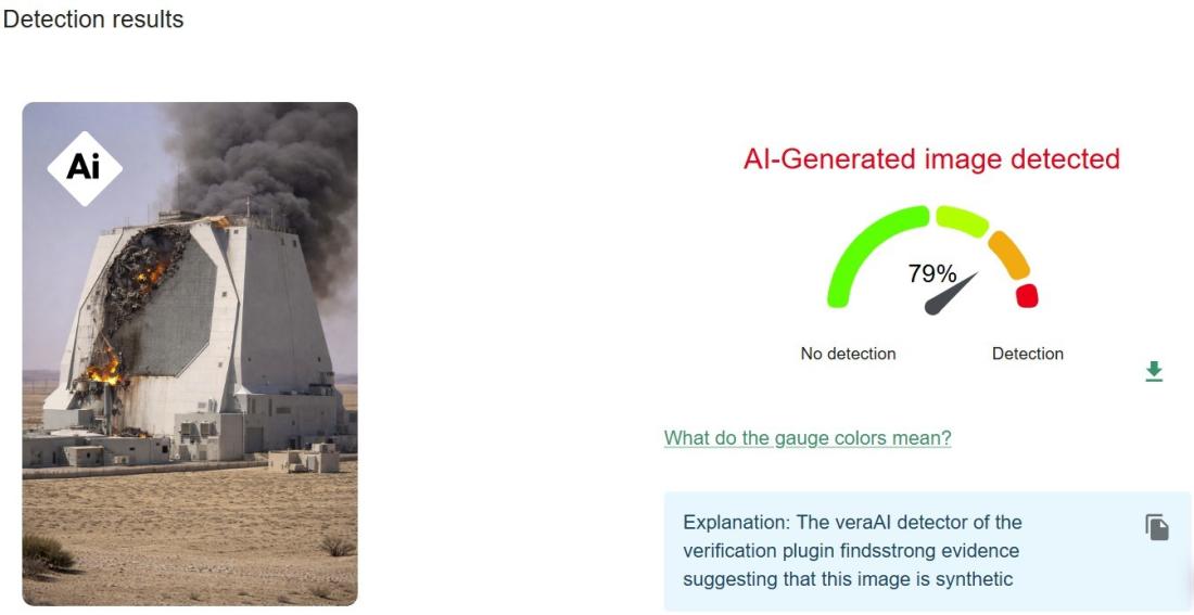
Iran has launched retaliatory attacks on US targets in multiple Middle East countries amid a war triggered by US-Israeli strikes on Tehran, and satellite imagery suggests a key radar system in Qatar was impacted. But a dramatic image spread online that purports to show the structure on fire appears to have been generated using artificial intelligence.
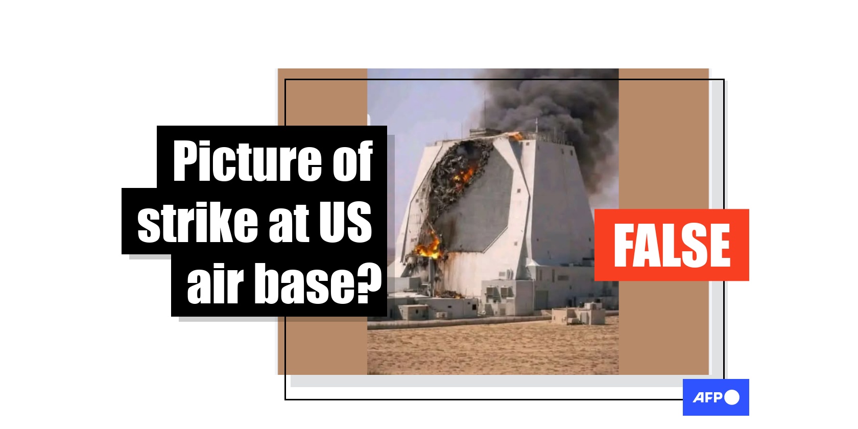
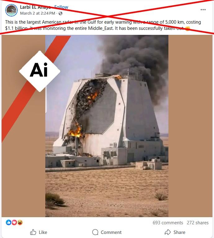
"This is the largest American radar in the Gulf," says a March 3, 2026 Facebook post sharing an image of a structure in the desert on fire. "It was monitoring the entire Middle East.. and it was bombed!"
Similar posts on Facebook, Instagram and X alleged that the picture showed the impact of an Iranian strike at the Al-Udeid Air Base in Qatar. The claim also circulated in Romanian, Polish and Greek.
Some accounts claimed the image depicted damage to an AN/FPS-132 radar installation monitoring for missiles outside Doha.
The war erupted February 28 after US-Israeli strikes killed Iran's supreme leader Ayatollah Ali Khamenei, triggering a wave of retaliatory attacks across the region.
US military bases have been targeted, including Al-Udeid.
But the picture of the destroyed radar block is not authentic. The image appeared in posts as early as February 28, days before the Qatari Defense Ministry reported strikes on Al-Udeid Air Base on March 3.
AI detected
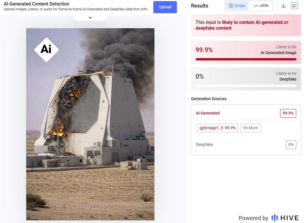
The InVID-WeVerify plugin and AI-detection tools from Hive Moderation and Image Whisperer all classified the image as highly likely to be the product of artificial intelligence.
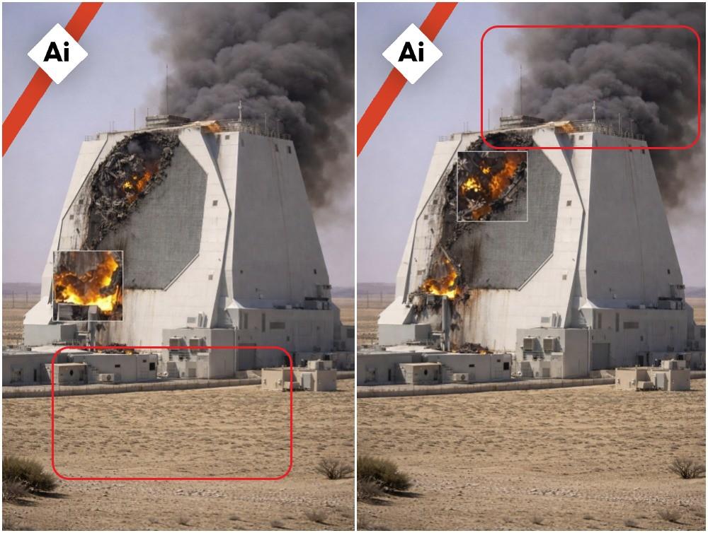
The image also contains several irregularities typical of images created using AI.
No debris from the supposed missile strike is seen on the ground below, for example, and the smoke is billowing from behind the radar rather than the damaged areas in the front.
Real radar not a match
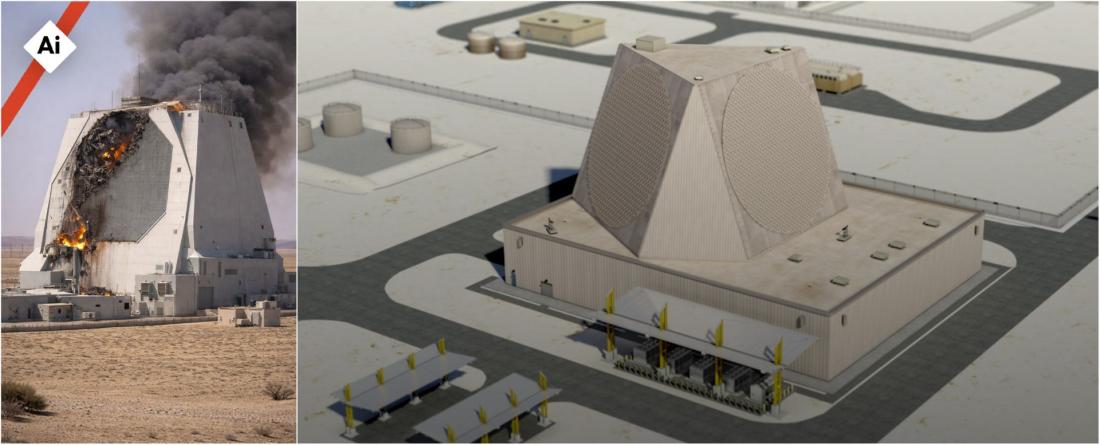
Further examination of illustrations released by the United States Air Force reveals inconsistencies between the real AN/FPS-132 radar installation and the AI depiction online (archived here).
The Air Force image shows circular shapes on the larger faces of the structure, connected by blank triangle faces. The fake image, by contrast, has sides in the shape of octagons and trapezoids.
Possible strike location
AFP was, however, able to identify the location of the early-warning radar referenced in the posts -- and found evidence that it could have been impacted by strikes.
Google Maps satellite imagery shows a radar facility located roughly 95 kilometers (59 miles) north of Al-Udeid Air Base, indicating the installation is separate from the military base itself.
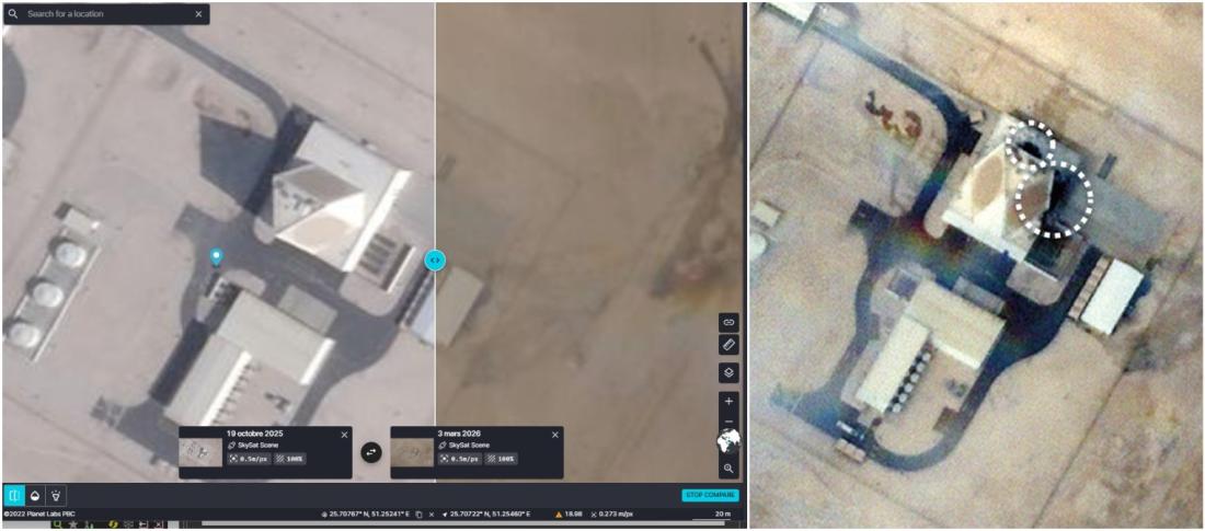
High-resolution satellite images of the radar site from March 3, captured by Planet Labs and provided to AFP, also show the installation located north of Al-Udeid Air Base.
The images show the site with two dark patches visible nearby. The visual also shows two spots on parts of the radar that could suggest traces of a direct impact.
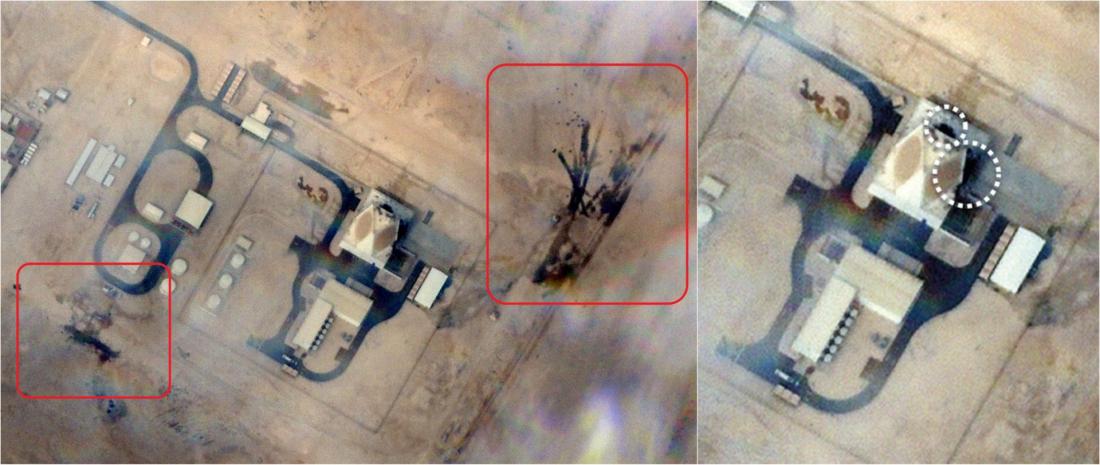
Earlier high-resolution images taken on October 19, 2025 do not show dark patches on the radar face.
Analysis of satellite images by some media outlets also examined the possibility of damage to Al-Udeid and other US bases in the region (archived here).
The war in the Middle East triggered a parallel narrative conflict online, creating a wave of false claims, many featuring AI images.
Read more of AFP's fact-checking on the war here.
Copyright © AFP 2017-2026. Any commercial use of this content requires a subscription. Click here to find out more.
Is there content that you would like AFP to fact-check? Get in touch.
Contact us