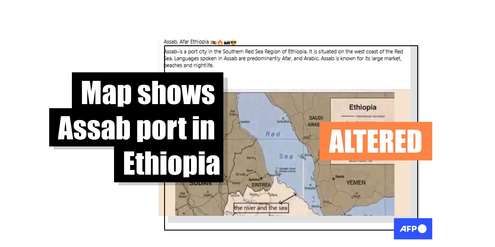
Altered map falsely shows Eritrea's Assab port as being part of Ethiopia
- This article is more than one year old.
- Published on March 21, 2025 at 16:00
- 3 min read
- By Tolera FIKRU GEMTA, AFP Ethiopia
Ethiopia’s quest for access to the Red Sea has become a hotly debated topic on social media. Posts with a map of the Red Sea region in the Horn of Africa claim that Eritrea's port of Assab is located in Ethiopia. However, this is false: the map has been altered. The area where the port is located in Eritrea has been redrawn within the border of Ethiopia.
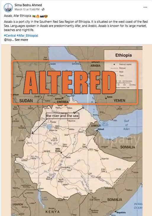
The post, published in English on Facebook on March 13, 2025, reads: “Assab, Afar Ethiopia”, followed by an emoji with the Ethiopian flag.
Afar is an ethnic group found in the Horn of Africa, mainly in Ethiopia but also in Eritrea and Djibouti.
“Assab is a port city in the Southern Red Sea Region of Ethiopia,” the post adds. “It is situated on the west coast of the Red Sea. Languages spoken in Assab are predominantly Afar, and Arabic.”
The post is accompanied by a map of the Horn of Africa in which Ethiopia’s borders appear to extend to the coast of the Red Sea, which is not the case in reality.
Similar posts were shared here and here on Facebook.
Tensions are rising in the conflict-ridden Horn of Africa after landlocked Ethiopia recently made a strong plea to regain access to the Red Sea. Ethiopia had access to the Red Sea via Assab before Eritrea became independent in 1993 and took over control of the port (archived here).
However, Ethiopian Prime Minister Abiy told parliament on March 20, 2025, that his country would not invade neighbouring Eritrea to gain access to the sea (archived here).
AFP Fact Check found that the map allegedly showing the port of Assab as part of Ethiopia has been redrawn.
Redrawn map
AFP Fact Check conducted reverse image searches and tracked down the original map (archived here). It was published in 2000 by Mapsland, a website that shares collections of maps from across the globe (archived here).
The original map is captioned in English and reads: “Ethiopia large detailed political map with roads, railroads and major cities - 2000.”
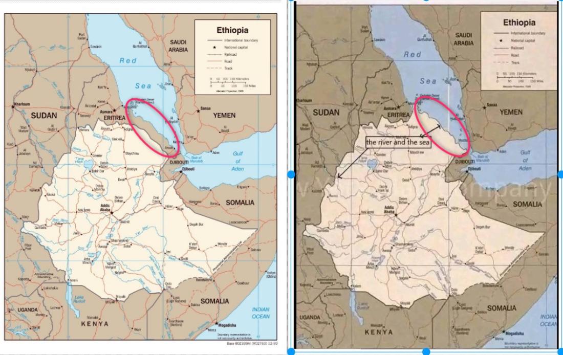
But, in this original map, Ethiopia does not border the Red Sea, and the port of Assab is located in Eritrea.
These are the same borders as can be seen on current maps, including Google Maps.
In the altered version of the map, Ethiopia’s borders have been moved to reach the sea and therefore encompass Assab. The map has been redrawn to support the false claim that “Asab is in the southern Red Sea region of Ethiopia”.
The following image presents a comparison of the original and modified maps.
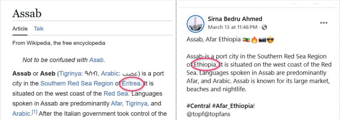
Meanwhile, the text in the post describing the location of Assab appears to have been lifted directly from the Wikipedia entry for the port, with one major change: the post has replaced the word “Eritrea” with “Ethiopia”.
AFP Fact Check has previously debunked claims related to Ethiopia controlling the port of Assab here.
Copyright © AFP 2017-2026. Any commercial use of this content requires a subscription. Click here to find out more.
Is there content that you would like AFP to fact-check? Get in touch.
Contact us