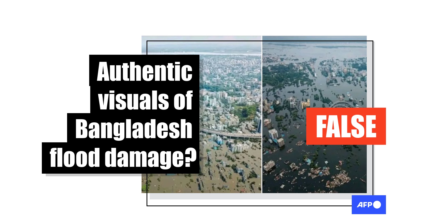
Images of largest port city in Bangladesh underwater are AI-generated
- Published on July 20, 2026 at 14:26
- 2 min read
- By Rasheek MUJIB, AFP Bangladesh
Relentless heavy rainfall across Bangladesh caused multiple flash floods in the region, especially impacting the hill tracts and the port city of Chittagong, but images shared online of a major flyover in the city underwater are fabricated. The pictures have been flagged as made with Google AI tools and an AFP stringer who covered the area said floodwaters there were not as high as shown in the picture, reaching waist-high levels at most during severe waterlogging.
"Today, the entire city of Chittagong is going under water, yet no one is paying attention; there is no major coverage in the media, and no discussion among civil society," reads part of a Bengali language caption of a Facebook post shared on July 10, 2026.
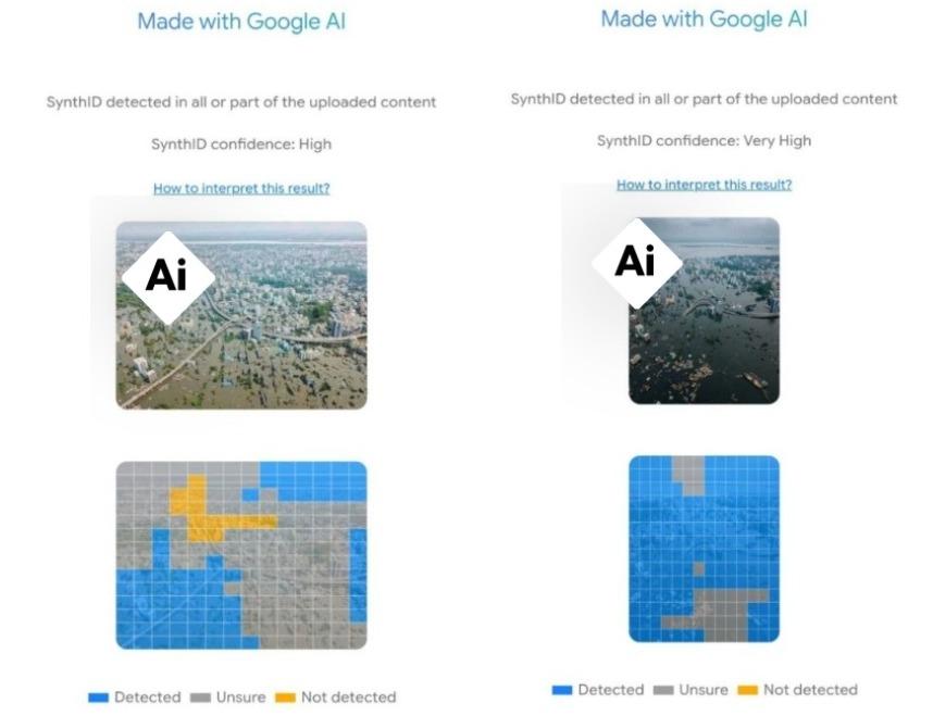
The two images shared in the post show a submerged city area close to a river, where a flyover can be seen going under water.
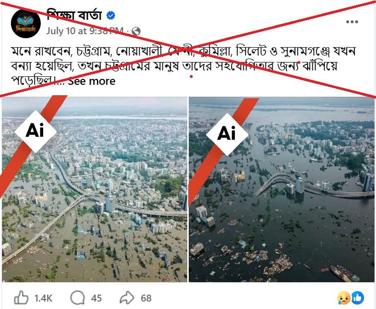
Similar posts surfaced elsewhere on Facebook and YouTube as flash floods triggered by relentless monsoon rains and hill torrents have contributed to a worsening crisis across Chittagong and its adjoining districts (archived link).
According to media reports, more than 50 people died so far in the country due to flash floods and landslides, though the situation seems to be improving slowly (archived link here and here).
More than half the deaths have occurred in Cox's Bazar, home to the largest Rohingya refugee population where several students and a teacher were killed when floodwaters swept through their school last week (archived link).
But the shared images are made with AI.
AI-generated images
An AFP stringer identified the road seen in the photos as the Akhtaruzzaman Chowdhury flyover in Chittagong, precisely the busstop at gate no 2 in the city. The flyover is the largest highway overpass in the port city, also known as the Muradpur Lalkhan Bazar flyover.
According to the stringer, floodwater usually go from knee high to waist high in the roads under the flyover, while the flyover remains passable and free of waterlogging.
A closer look at the aerial view of the flyover in Google Maps shows multiple high-rise buildings in the turn of the flyover, while the false images show lowlands surrounding the area (archived link). There are also open spaces with trees in the images, which do not match with the Google Maps view.
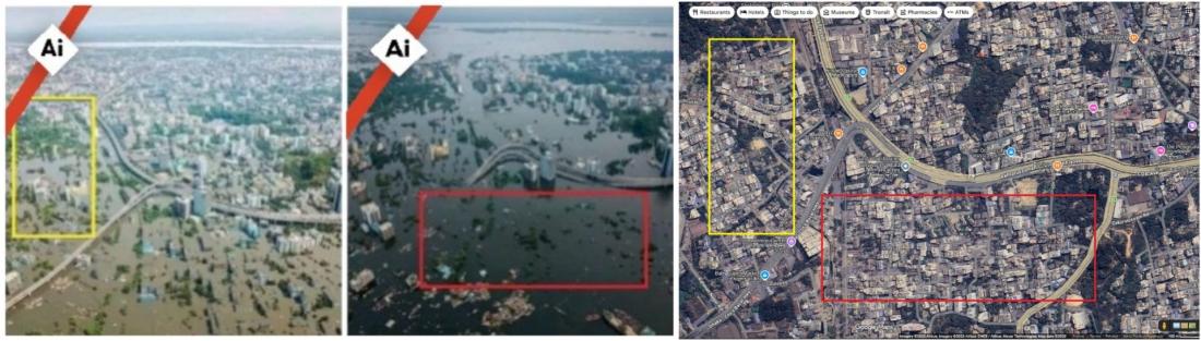
An AFP analysis of the images also found irregularities typical of AI-generated visuals such as having vessels wading in the floodwaters filled with high-rise buildings and roads completely disappearing in the second image from the same location.
A SynthID detection result of the images shows they were generated with GoogleAI.
AFP has debunked other misinformation about Bangladesh floods here.
Copyright © AFP 2017-2026. Any commercial use of this content requires a subscription. Click here to find out more.
Is there content that you would like AFP to fact-check? Get in touch.
Contact us