Posts misrepresent old picture as damage from recent Myanmar clashes
- Published on October 23, 2025 at 07:03
- 2 min read
- By AFP Thailand
Myanmar's ruling junta said in October 2025 that it had recaptured from an ethnic armed group a town on a trade highway to China. Online posts that surfaced during the fighting falsely claimed a major bridge had been severely damaged. However, the picture they shared depicts a crossing destroyed a year ago in a state hundreds of kilometres (miles) away.
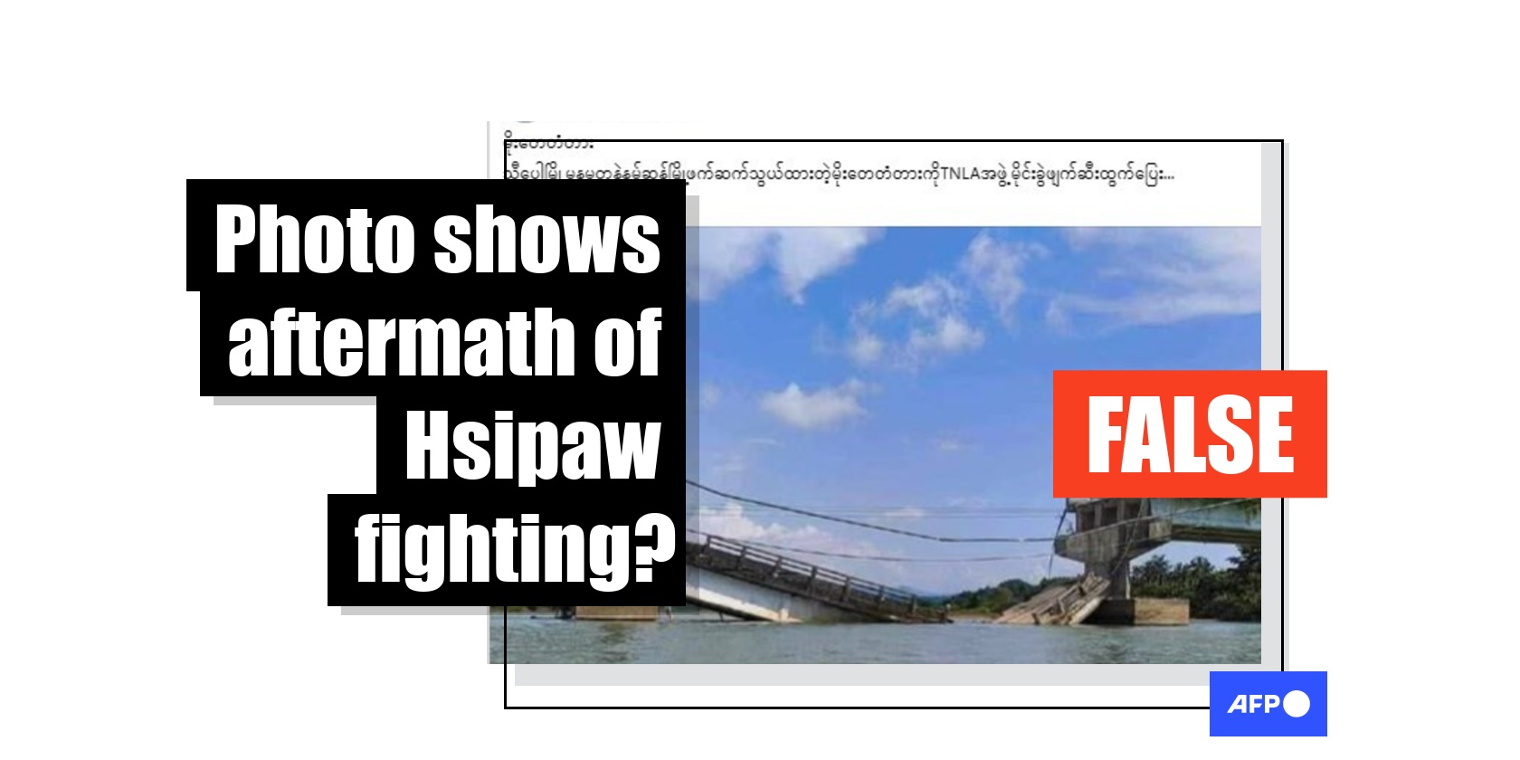
"The TNLA group detonated and destroyed the Moe Tay Bridge, which connects Hsipaw with Namtu and Namsang townships, and fled," reads a Burmese-language Facebook post on October 8, 2025, using the acronym for the ethnic armed group Ta'ang National Liberation Army and mentioning three towns in Myanmar's war-wrecked Shan state.
The accompanying image shows a collapsed bridge.
Similar posts also circulated on X and TikTok as the ruling junta and the TNLA battled for control over Hsipaw town, where a highway to China's Yunnan province passes through. According to the state-run Global New Light of Myanmar newspaper, the military reoccupied Hsipaw completely on October 16 (archived link).
There have been no official reports the Moe Tay Bridge had been destroyed during the clashes.
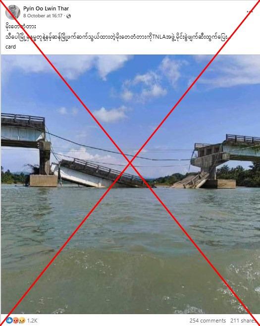
Local news outlet Shan News earlier reported the crossing collapsed but later retracted its article (archived link). "A re-examination of the Moe Tay Bridge, located in Hsipaw Township, Shan state, revealed that it was not actually damaged," it said on October 8.
AFP reached out to a resident of Hsipaw who saw no damage to the bridge as of October 13.
A reverse image search on Google was not able to trace the source of the circulating picture but a keyword search found it corresponds to a photo published by the Irrawaddy newspaper on October 8, 2024 (archived link).
The report identifies the structure as the Kyeintali Chaung Bridge in western Rakhine state -- located over 600 kilometres (370 miles) away from Moe Tay Bridge. It said the bridge was destroyed by junta troops.
Myanmar has been mired in civil war since a 2021 coup deposed the civilian government, with the military battling a myriad of pro-democracy guerrillas and ethnic armed organisations.
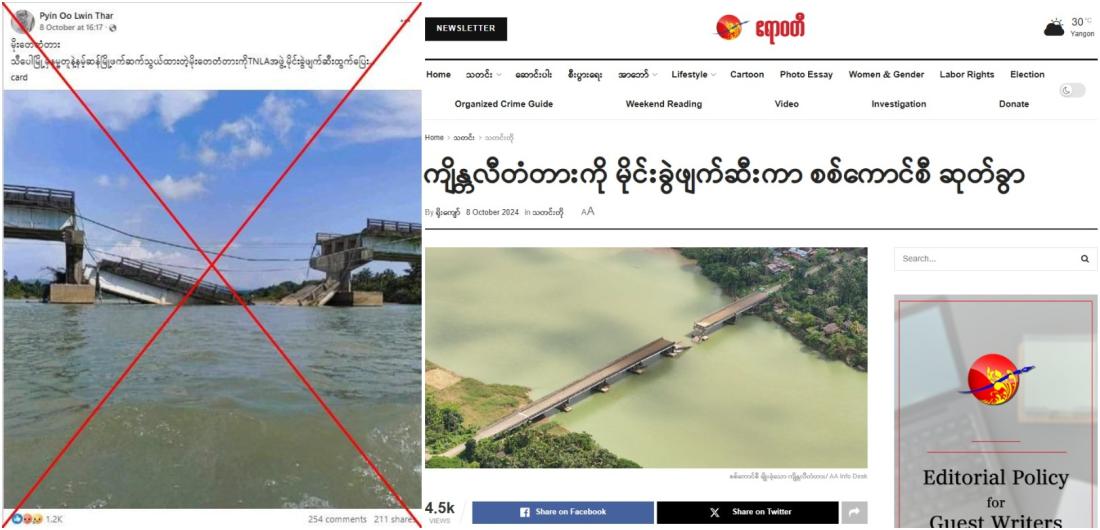
The Irrawaddy credits the photo to AA info desk -- a website affiliated with the Arakan Army, a predominantly Buddhist ethnic armed group that fights the junta (archived link).
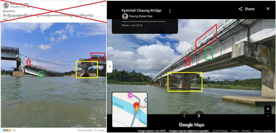
AFP was able to confirm the location of the bridge by comparing it to geotagged images of the Kyeintali Chaung Bridge on Google Maps (archived link).
AFP has fact-checked more misinformation related to the Myanmar unrest here.
Copyright © AFP 2017-2026. Any commercial use of this content requires a subscription. Click here to find out more.
Is there content that you would like AFP to fact-check? Get in touch.
Contact us