Radar stations did not direct Hurricane Helene
- This article is more than one year old.
- Published on October 16, 2024 at 21:08
- 3 min read
- By AFP USA
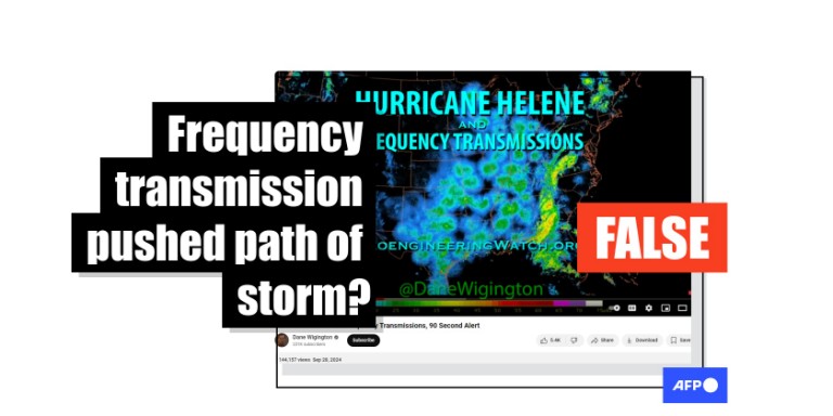
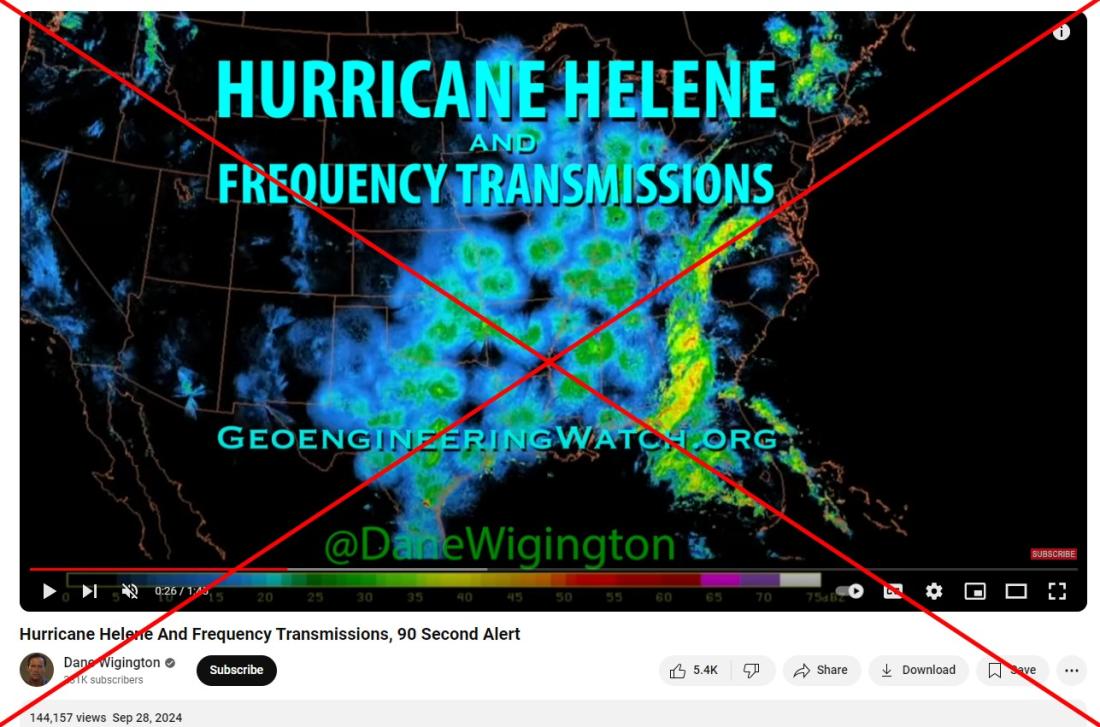
"Frequency transmissions can and do have a repelling effect on air masses, especially if and when the air masses have been seeded with electrically conductive nanoparticles," claims YouTuber Dane Wigington in a September 28, 2024 video.
Text over the clip indicates it shows radar measurements during Hurricane Helene. Wigington goes on to allege the blue-green dots on the map to the west of the storm were part of a transmission system that artificially guided its path.
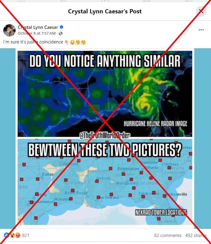
Different versions of the video, along with an interview of Wigington making the same claims, later jumped to Instagram and Facebook. A photo comparing similar transmission patterns to alleged NEXRAD tower locations implies they were responsible for Helene's movement.
Hurricane Helene made landfall September 26 in the state of Florida, moving up the east coast of the United States and causing flooding damage unusually far above sea level, particularly in North Carolina.
The weather manipulation claims are the latest in a large wave of false assertions about the origins of Helene and Hurricane Milton, which struck Florida on October 10.
A National Oceanic and Atmospheric Administration (NOAA) statement sent to AFP by the NWS on October 10 said Milton and Helene formed naturally due to converging sea surface temperatures and upper atmospheric winds. NEXRAD -- a nationwide network of radars operated by the Federal Aviation Administration, the US Air Force and the NWS (archived here) -- did not influence the storm's path.
"There is no technology that humans have that can either create, destroy, modify, intensify or steer hurricanes in any way, shape or form," NOAA said in the statement.
'Ground clutter'
According to the NWS, NEXRAD radars emit short pulses of energy to detect small targets -- such as raindrops -- to determine their shape or intensity relative to the sensor.
"The radar is unable to direct the motion or intensity of air masses or storms," the NWS said in an October 10 email.
Christopher Rozoff, a project scientist at the National Center for Atmospheric Research (NCAR) in Colorado (archived here), said in an October 10 email that the circular patterns visible around the station locations are a normal feature of radar maps.
In clear conditions, radars pick up what meteorologists call "ground clutter," which can include insects, birds or dust in the atmosphere and appear as a circular shape around the stations (archived here).
Rozoff said the shape of weather systems such as hurricanes will appear more defined on the maps since precipitation is more obvious to the radars than ground clutter. But he said there is no causal connection between weather radar and activity in the atmosphere.
"The radio waves simply travel out to space or hit an object (like a snowflake) and bounce backward," he said.
Scott Ellis, another project scientist at NCAR (archived here), told AFP in an October 10 email that the dots to the west of the storm are radars reflecting insects, with some birds mixed in. He added that removing the quality control filter from the Multi-Radar Multi-Sensor (MRMS) viewer reveals similar disks on any given day (archived here).

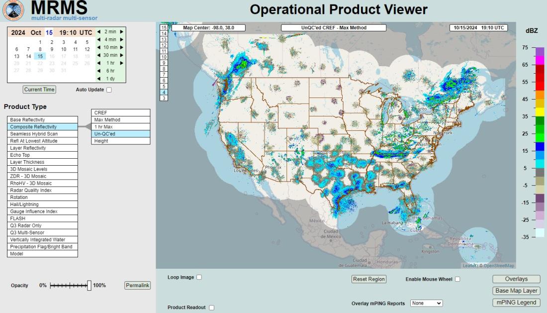
More concentrated dots appear in the southeastern United States, Ellis said, because more insects live in that region in deeper layers, making them easier for radar to detect.
Science Feedback reported the NEXRAD images circulating online may display a large bird migration that coincided with Hurricane Helene. Researchers and enthusiasts frequently use the technology to track migratory patterns (archived here).
AFP attempted to examine the NEXRAD live display online, but as of October 16 the site returned a message saying some NOAA products are being updated due to an outage from Hurricane Helene (archived here).
Read more of AFP's reporting on misinformation around hurricanes here.
Copyright © AFP 2017-2026. Any commercial use of this content requires a subscription. Click here to find out more.
Is there content that you would like AFP to fact-check? Get in touch.
Contact us
