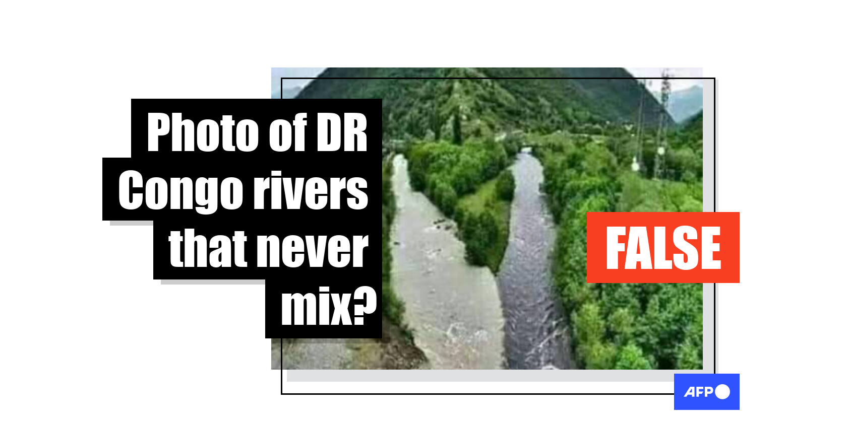
This photo of rivers that 'never mix' was taken in Georgia, not in DR Congo
- This article is more than five years old.
- Published on October 12, 2020 at 16:39
- 4 min read
- By Ange KASONGO
A Facebook page called Facts from Africa posted the picture alongside the caption: “Kasai and Mai Ndombe rivers in Democratic Republic of Congo meet but never mix-up.” Facebook’s Page Transparency locates the page’s administrators in Tanzania, Uganda, Cameroon, Kenya, Rwanda, Sierra Leone and South Africa.
The picture captures two streams of different colours, one light gray and the other a darker shade, flowing parallel to each other at the foot of a small mountain in a lush green landscape.
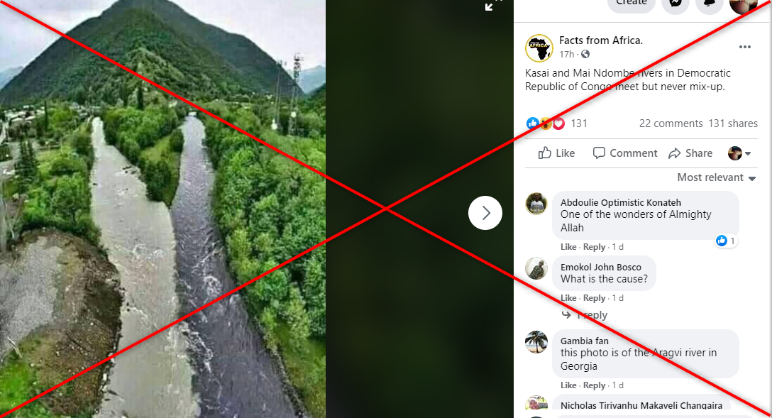
The same claim was also shared thousands of times in a French Facebook post.
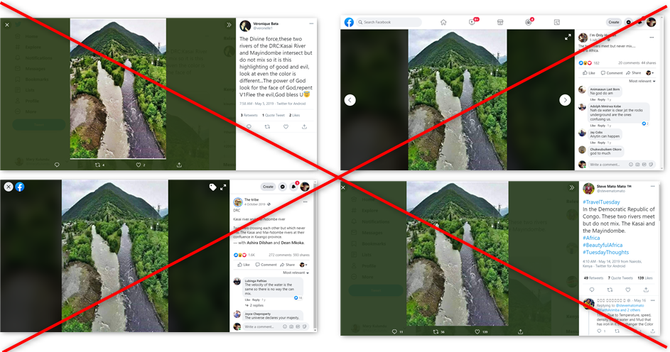
A reverse image search indicated that the claim has been circulating online since 2019 on Twitter (here and here) and Facebook (here, here and here).
All the posts purport that this shows the Kasai and Mai-Ndombe rivers in DR Congo.
Not in DR Congo
Pax Mbuyi Mucici, a geographer at the Geographical Institute of Congo, told AFP Fact Check that “there is no Mai-Ndombe river (...) but rather a lake”.
Lake Mai-Ndombe, which was formerly referred to as Lake Leopold II, means “black water” in the Lingala language.
Mucici added that Lake Mai-Ndombe does not directly flow into the Kasai river.
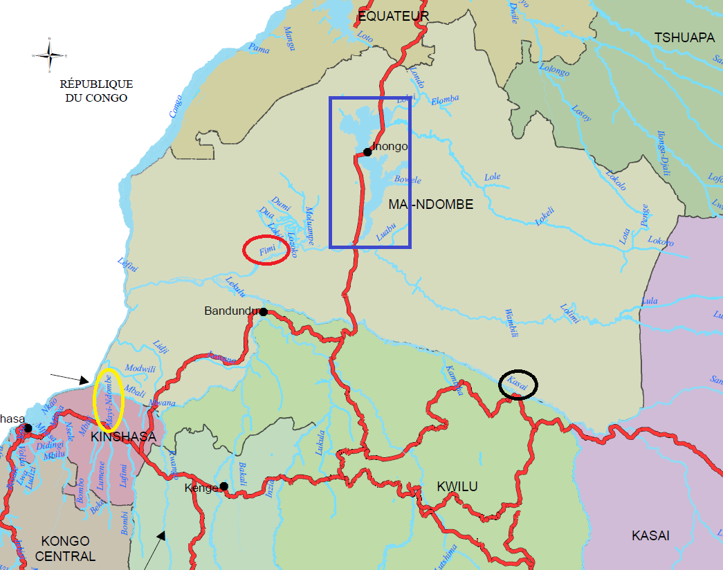
“The waters of Lake Mai-Ndombe are channelled by the Fimi River, which intersects with the Kasai River in Mushie territory,” Mucici said.
The map below shows Fimi River (red arrows) flowing into the Kasai river (black arrows), more than a hundred kilometres west of Lake Maï-Ndombe (blue rectangle).
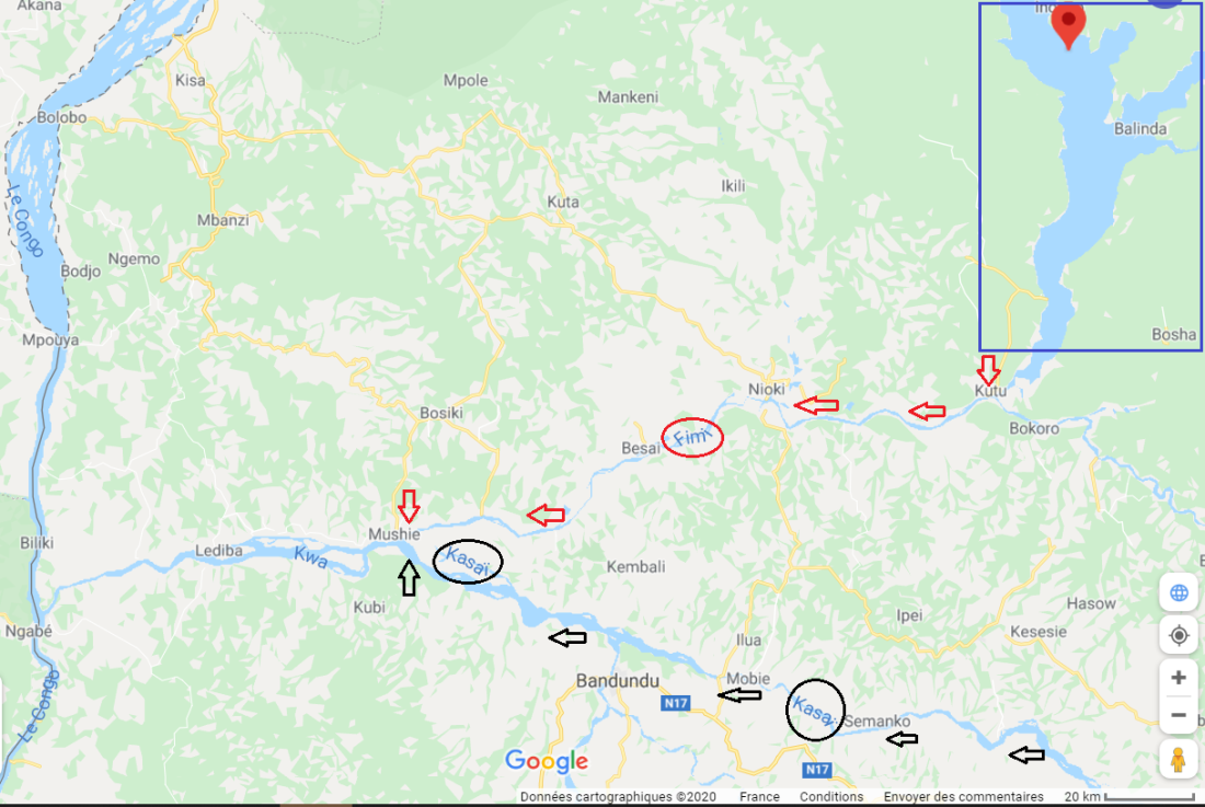
While there is no mention of a Mai-Ndombe river on any online maps, some offline maps mention a river by that name near the capital Kinshasa. Circled in yellow on the map below, it flows into the Lufimi river; however, at no point does it meet the Kasai river (circled in black).
Landscape differences
Léon Lundula, a geographer with the National Pedagogical University of Kinshasa, said that the landscape seen in the photo did not make any sense. “These rivers are not in mountainous areas,” Lundula said.
Some online users also challenged the photo’s alleged location of DR Congo, with one commenting that the photo showed the Aragvi river in Georgia.
Black Aragvi and White Aragvi
A search of the keywords “Aragvi river” on Google reveals an article from itinari.com, which describes itself as a platform for travellers “looking for the best-kept spots and hidden gems”.
The article, titled: “The most spectacular rivers of Georgia”, describes the Aragvi river at length.
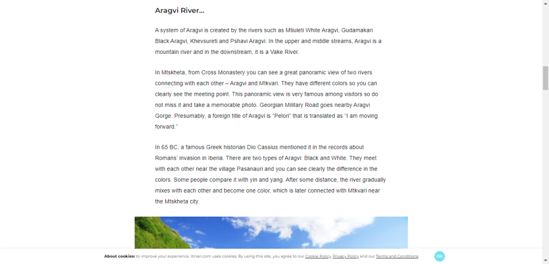
“There are two types of Aragvi: Black and White. They meet with each other near the village Pasanauri and you can see clearly the difference in the colors. Some people compare it with yin and yang. After some distance, the river gradually mixes with each other and become (sic) one colour, which is later connected with Mtkvari near the Mtskheta city,” the author writes.
Pasanauri is located 90 kilometres north of the Georgian capital Tbilisi. On Google Maps, images similar to the one from the Facebook posts are associated with the town (marked in red below).

Google Maps offers a view of the site dated June 2019. AFP Fact Check compared it to the photo from the Facebook posts, and the elements match: notice the streams of two colours meeting below the same small mountain, as well as antennas with white parabolas on the right side of the river.


We also found videos of the Aragvi river on YouTube here and here.
Water density
“The waters (of the Aragvi) have different chemical compositions and density,” Anano Chikhradze, the author of the itinari.com article, told AFP Fact Check.
While the photo shared on Facebook was not taken in DR Congo, this natural phenomenon does occur there, too.
“The water of the Congo River at the mouth of the ocean has a different colour, because of the difference in density due to the rate of salinity,” the geographer Mucici said. “The water in the ocean is saltier and denser than that of the river, which explains the difference in colour.”
Copyright © AFP 2017-2026. Any commercial use of this content requires a subscription. Click here to find out more.
Is there content that you would like AFP to fact-check? Get in touch.
Contact us