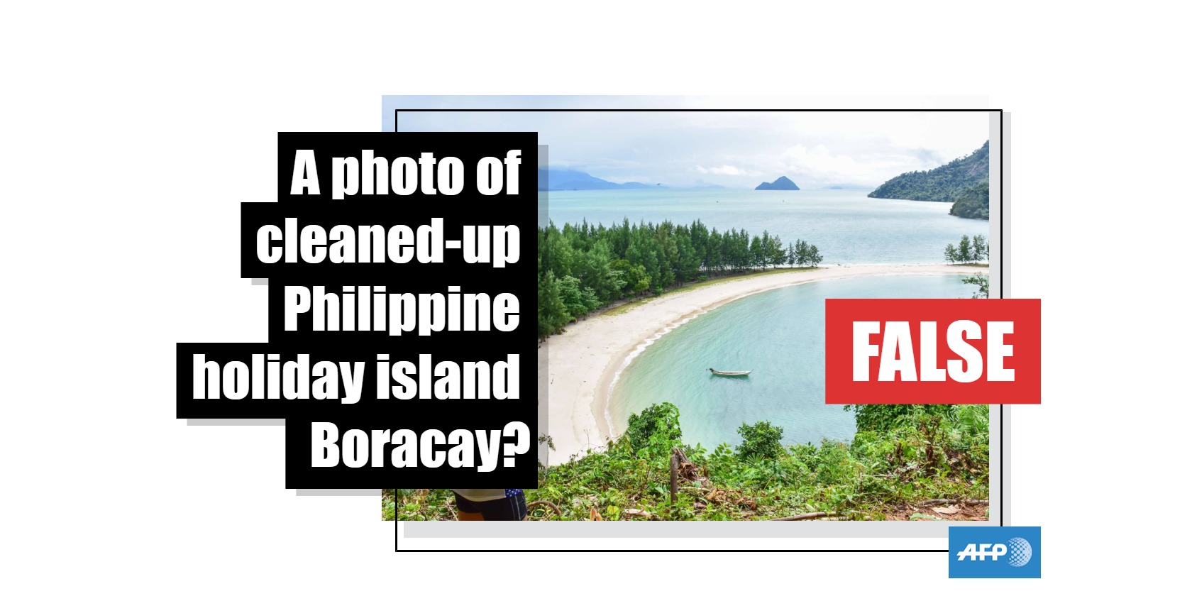
No, this photo does not show the rehabilitated Philippine tourist destination of Boracay
- This article is more than seven years old.
- Published on October 12, 2018 at 07:45
- 2 min read
- By AFP Philippines
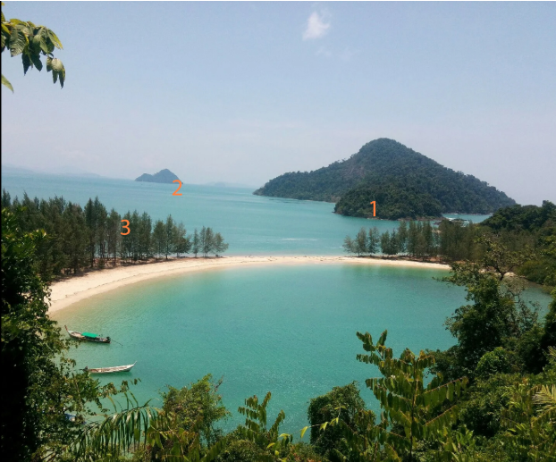
A Facebook post shared a photograph that it claimed showed Boracay, a top tourist destination in the Philippines, after a major clean-up which started in April this year.
The post says: "Wow! Boracay is so beautiful and is now ready for its re-opening in October. Thanks to Digong our father because you're the only one who can make this kind of change".
Digong is a nickname for Philippine President Rodrigo Duterte.
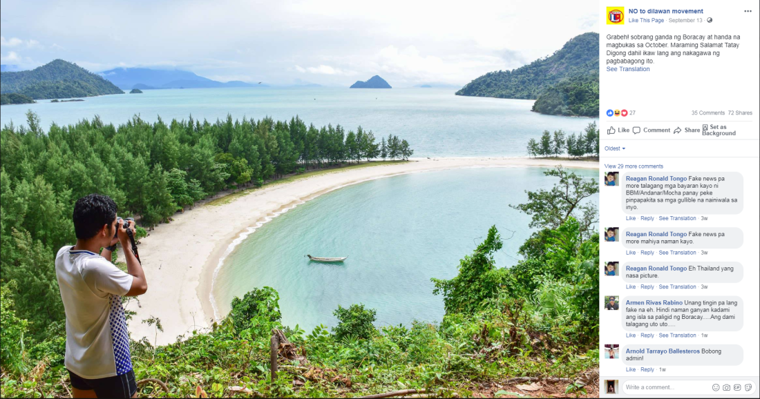
A reverse image search found that the photo actually showed Ao Khao Kwai in the Kham Tok Islands in Thailand.
The search found that the image was first posted online by the stock photography company Shutterstock, under the account of photographer Teerasak Khunrach.
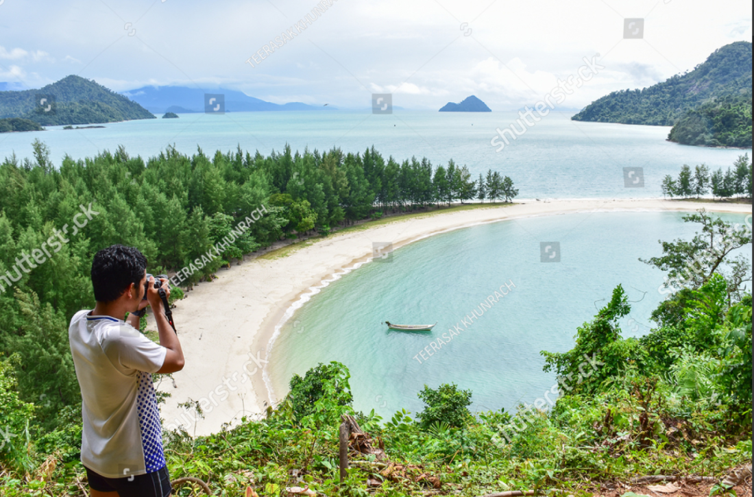
Photographer Teerasak Khunrach, who is from Thailand, told AFP that he had taken the photo.
"Yes, that is my photo," he said. "I took it on November 6, 2016. This is in Ao Khao Kwai, Kham Tok Islands, Thailand".
Using the information provided by Teerasak and a reverse image search, AFP confirmed that this image was taken on the island of Ko Kham, and not on Boracay.
A set of indicators enabled AFP to demonstrate that this photo was taken on Ko Kham:
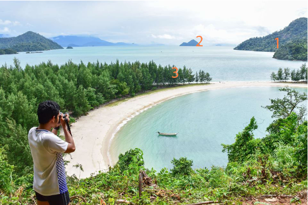
1 - The presence of two slopes -- a smaller one in front of a larger slope
2 - A distinctively shaped island, with the slope of the left side being smaller than the one on the right side
3 - The trees which hug the shoreline
A search using Google Maps in street view found that all three of these indicators were present. The shape of the coastline also matched that found in the photograph.
The image on Google Maps was taken approximately four months after the Shutterstock photographer took the original photo.
Boracay was closed to tourists in April for rehabilitation after Duterte called it a "cesspool". The department of tourism has said it will be reopened in October.
Copyright © AFP 2017-2026. Any commercial use of this content requires a subscription. Click here to find out more.
Is there content that you would like AFP to fact-check? Get in touch.
Contact us
