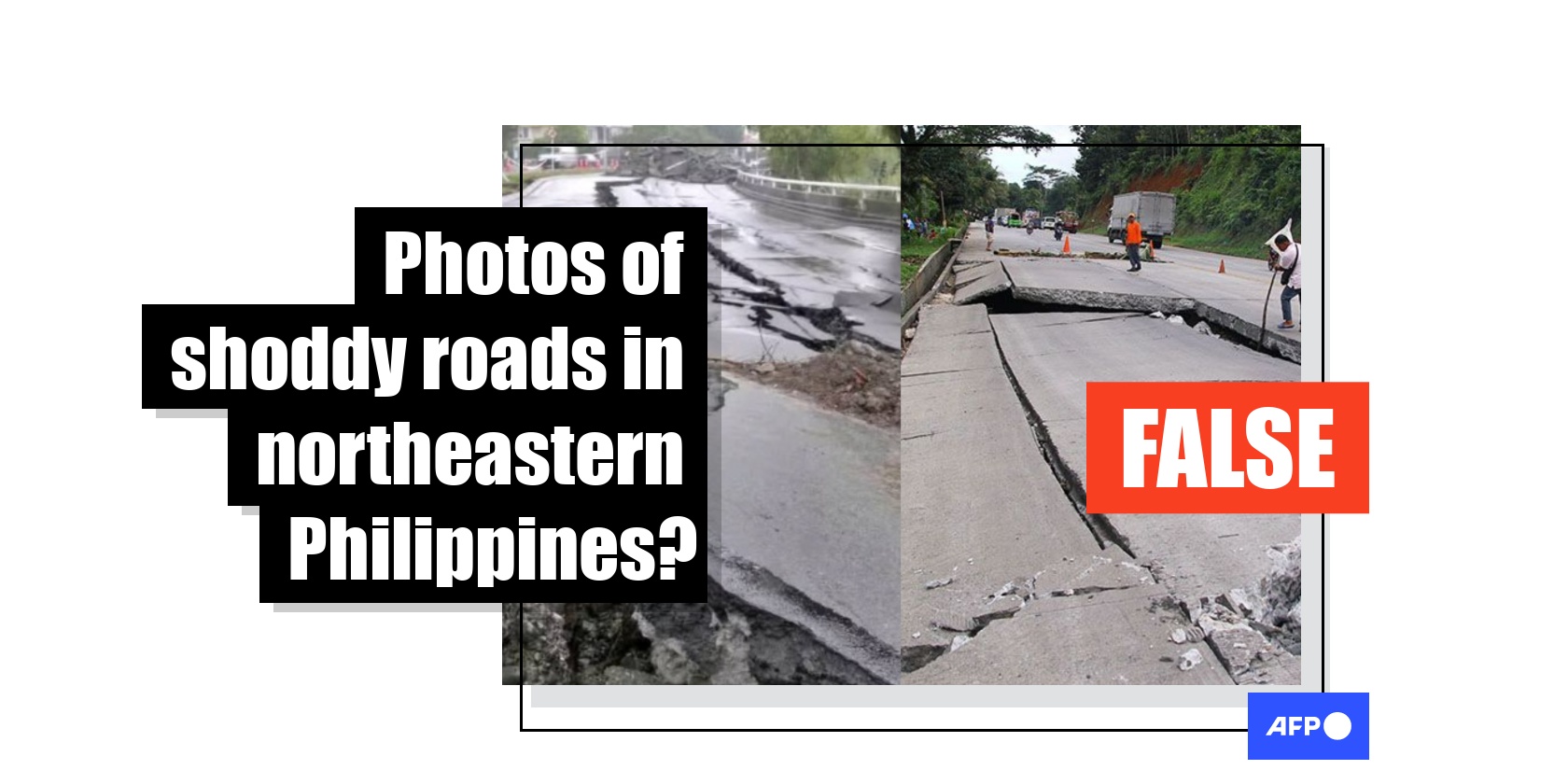
Old images of quake-damaged roads falsely linked to Philippines' public works scandal
- Published on September 29, 2025 at 10:50
- 2 min read
- By Lucille SODIPE, AFP Philippines
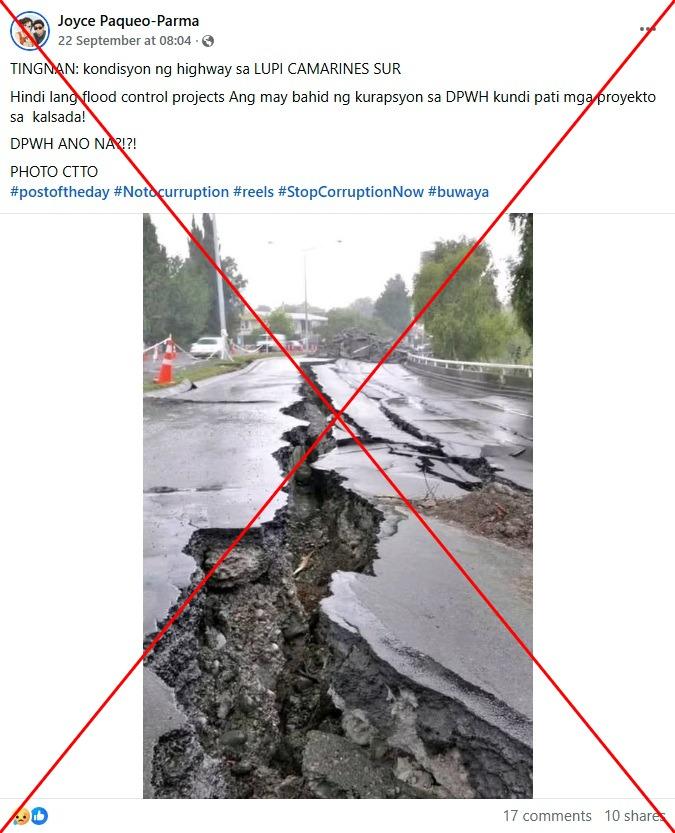
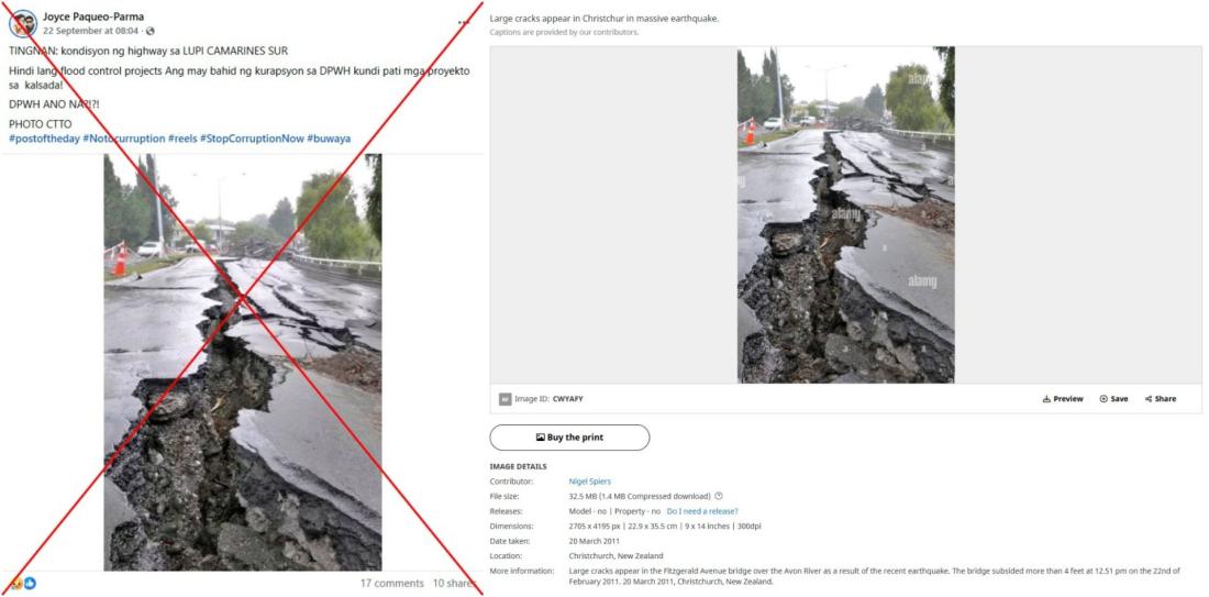
"LOOK: The highway's condition at Lupi, Camarines Sur," reads part of the Tagalog-language caption of a Facebook photo shared on September 22, 2025.
"It's not only flood-control projects that are tainted with corruption at the [Department of Public Works and Highways]; even the road projects are. What now DPWH?!?!"
The photo shows deep cracks along the length of an asphalt road, supposedly in Lupi, a town in the Philippines' northeastern Camarines Sur province.
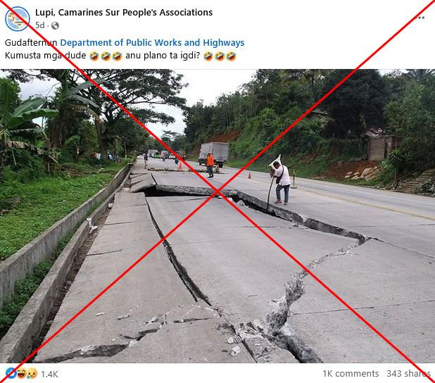
A similar photo also circulated on Facebook on September 18, alongside claims it shows road repairs in the same town.
The Philippines' Department of Public Works and Highways (DPWH) has been embroiled in a ballooning scandal involving bogus flood-control projects believed to have cost taxpayers billions of dollars (archived link).
Thousands took to the streets in Manila on September 21 to vent their anger over the scandal in largely peaceful anti-corruption rallies.
But the photos circulating online in fact show roads damaged by earthquakes.
2011 Christchurch quake
A reverse image search on Google fund the first falsely shared photo was published on the website of British photo agency Alamy on March 20, 2011 (archived link).
"Large cracks appear in Christchurch in massive earthquake," reads its caption, adding that the photo was taken at the Fitzgerald Avenue bridge over the Avon River (archived link).
Christchurch was hit by a 6.3 magnitude earthquake on February 23, 2011, which left 185 dead and cost the country billions of dollars in damages (archived link).
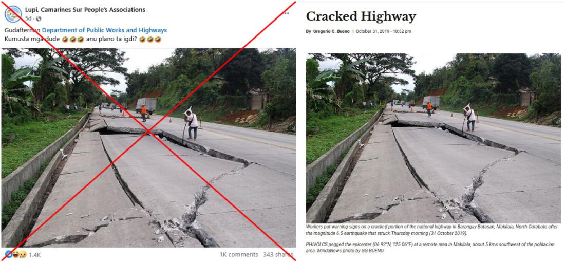
2019 Mindanao island quake
A separate reverse image search found the second falsely shared photo was previously published by MindaNews, a media organisation based in the southern Philippines island of Mindanao, on October 31, 2019 (archived link).
The photo's caption reads: "Workers put warning signs on a cracked portion of the national highway in Barangay Batasan, Makilala, North Cotabato after the magnitude 6.5 earthquake that struck Thursday morning."
AFP reported that the tremor was the third deadly quake to rattle the region within a matter of weeks (archived link).
The photo also matches Google Street View imagery of the Davao-Cotabato highway in the southern Philippines (archived link).
Mindanews used the photo in at least two more follow up stories published on November 7, 2019 and February 18, 2020 (archived here and here).
AFP has previously debunked other misinformation linked to the anti-corruption protests in the Philippines.
Copyright © AFP 2017-2026. Any commercial use of this content requires a subscription. Click here to find out more.
Is there content that you would like AFP to fact-check? Get in touch.
Contact us