
Construction mishap photo misused in news reports of January 2025 Taiwan quake
- This article is more than one year old.
- Published on January 21, 2025 at 09:43
- Updated on January 22, 2025 at 06:28
- 2 min read
- By Tommy WANG, AFP Hong Kong
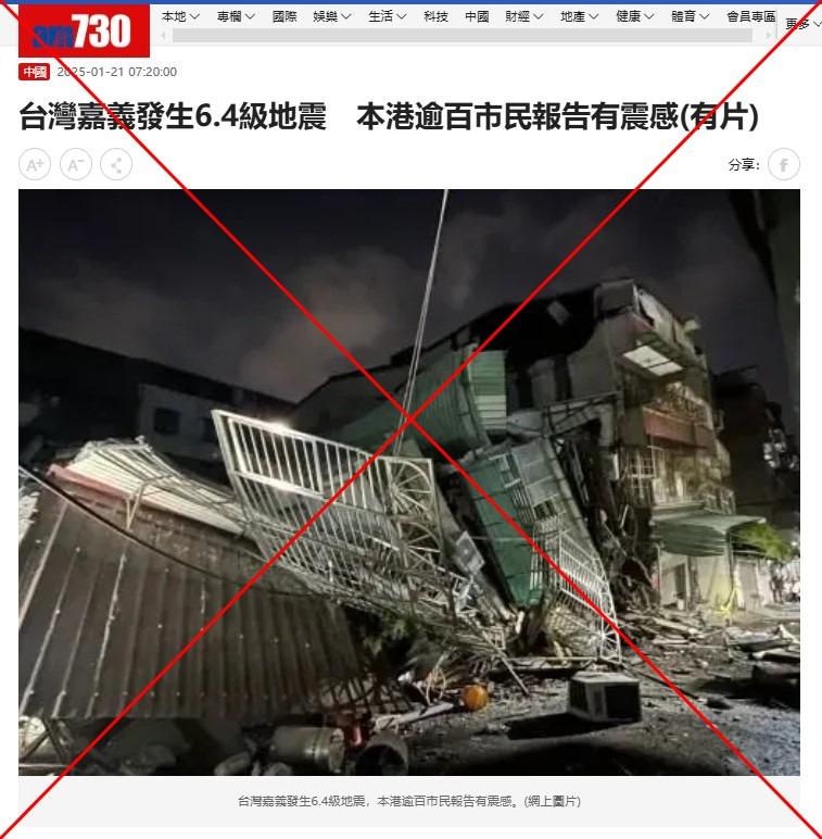
The picture was included in a report by Hong Kong media outlet am730 about the earthquake in Taiwan, which injured 27 people and also triggered landslides (archived link).
Taiwan's Central Weather Administration said the epicentre was recorded in southwest Taiwan's Chiayi county (archived link).
The picture was also published by other Chinese-language media outlets including China Times and Kankan News, as well as shared repeatedly in online forums here and here.
However, a combined reverse image and keyword search on Google traced it to a report published by Taiwan's Central News Agency (CNA) on January 6, 2025 (archived link).
The photo was credited to the New Taipei City Public Works Department.
The CNA report stated excavations in a basement in the city's Liuzhang Street had caused two of the neighbouring buildings to tilt, with one collapsing before it could be demolished.
Below is a screenshot comparison of the misrepresented picture in the news reports about the earthquake (left) and the one published by CNA (right):
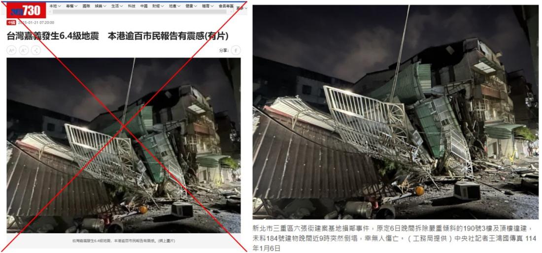
Liuzhang Street is located 140 miles (220 kilometres) away from the quake's epicentre in Chiayi.
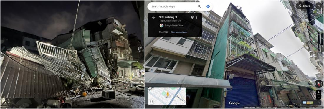
Google Maps street imagery of the area shows a building with the same facade as the one that collapsed seen in the photo published by CNA (archived link).
Below is a screenshot comparison of the image published by CNA (left) and the street view imagery on Google Maps (right):
January 22, 2025 Corrects a typo in paragraph 9
Copyright © AFP 2017-2026. Any commercial use of this content requires a subscription. Click here to find out more.
Is there content that you would like AFP to fact-check? Get in touch.
Contact us