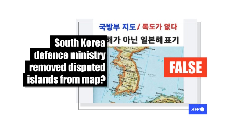
Stock image falsely shared as 'official' South Korean defence ministry map
- This article is more than one year old.
- Published on May 20, 2024 at 09:30
- 2 min read
- By SHIM Kyu-Seok, AFP South Korea
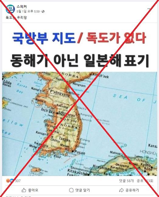
"Dokdo is our land," reads a Korean-language Facebook post that shared the map on May 1, 2024.
Seoul has controlled the Dokdo islands off its east coast since 1945, when Tokyo's colonial rule of the Korean peninsula ended.
But Tokyo says the islands -- known as Takeshima in Japan -- are being illegally occupied.
The map shows South Korea but with the islets missing. The body of water between the country and Japan is also labelled "Sea of Japan" rather than Seoul's official name East Sea.
Korean text above the map says: "Defence ministry map – Dokdo is not labelled. The map also shows the Sea of Japan instead of the East Sea."

The claim surfaced after a map marking Dokdo as Japanese territory appeared in an online civil defence course administered by South Korea's interior ministry, prompting controversy online (archived link).
The ministry in response deleted the map and explained it had been mistakenly added by an external company tasked with building the courses.
The claim was shared in similar Facebook posts including here and here.
Stock image
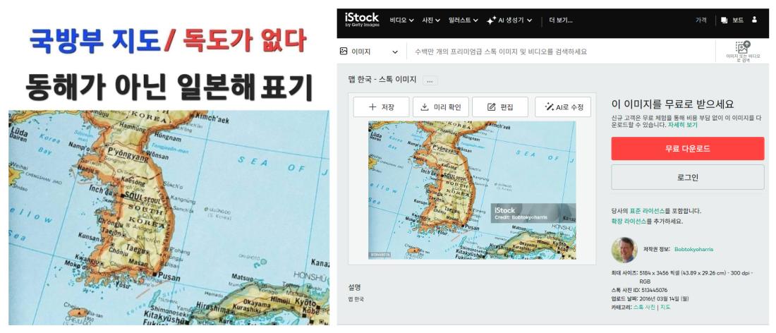
A reverse image search on Google found the map posted on the iStockphoto website on March 14, 2016 (archived link).
Below is a screenshot comparison between the image shared with the false claim on Facebook (left) and the original image posted on iStockphoto (right):

The picture was posted by an iStockphoto account called Bobtokyoharris, which regularly posts images of maps and globes (archived link).
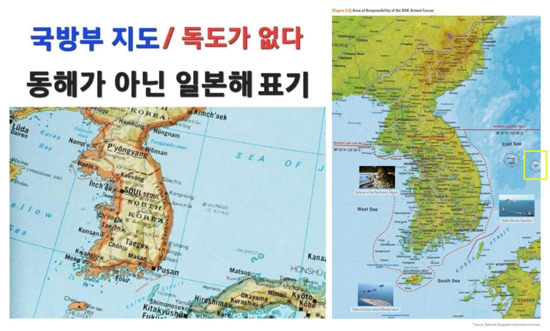
Meanwhile, South Korea's defence ministry confirmed that official maps always used the East Sea label.
"We cannot determine the source of this map in question, but the Republic of Korea's defence ministry uses maps with the East Sea label," a ministry spokesman told AFP on May 16.
"It does not make sense that this could be a defence ministry document when we are continually making efforts to rectify wrongful labels in international media that do not use the 'East Sea' name through foreign ministry channels and official complaints," he said.
Below is the map shared in false Facebook posts (left) and an official map published in the defence ministry's 2022 white paper, with Dokdo highlighted in yellow by AFP (right) (archived link):

Furthermore, the map shared in social media posts uses the old McCune-Reischauer romanisation system for the Korean language (archived link).
Seoul dropped the system in 2000 in favour of a revised system that it said represented local pronunciation more accurately (archived link).
Copyright © AFP 2017-2026. Any commercial use of this content requires a subscription. Click here to find out more.
Is there content that you would like AFP to fact-check? Get in touch.
Contact us
