Old photos of ground fissures falsely linked to massive Philippine quake
- This article is more than two years old.
- Published on December 18, 2023 at 04:41
- 2 min read
- By Lucille SODIPE, AFP Philippines
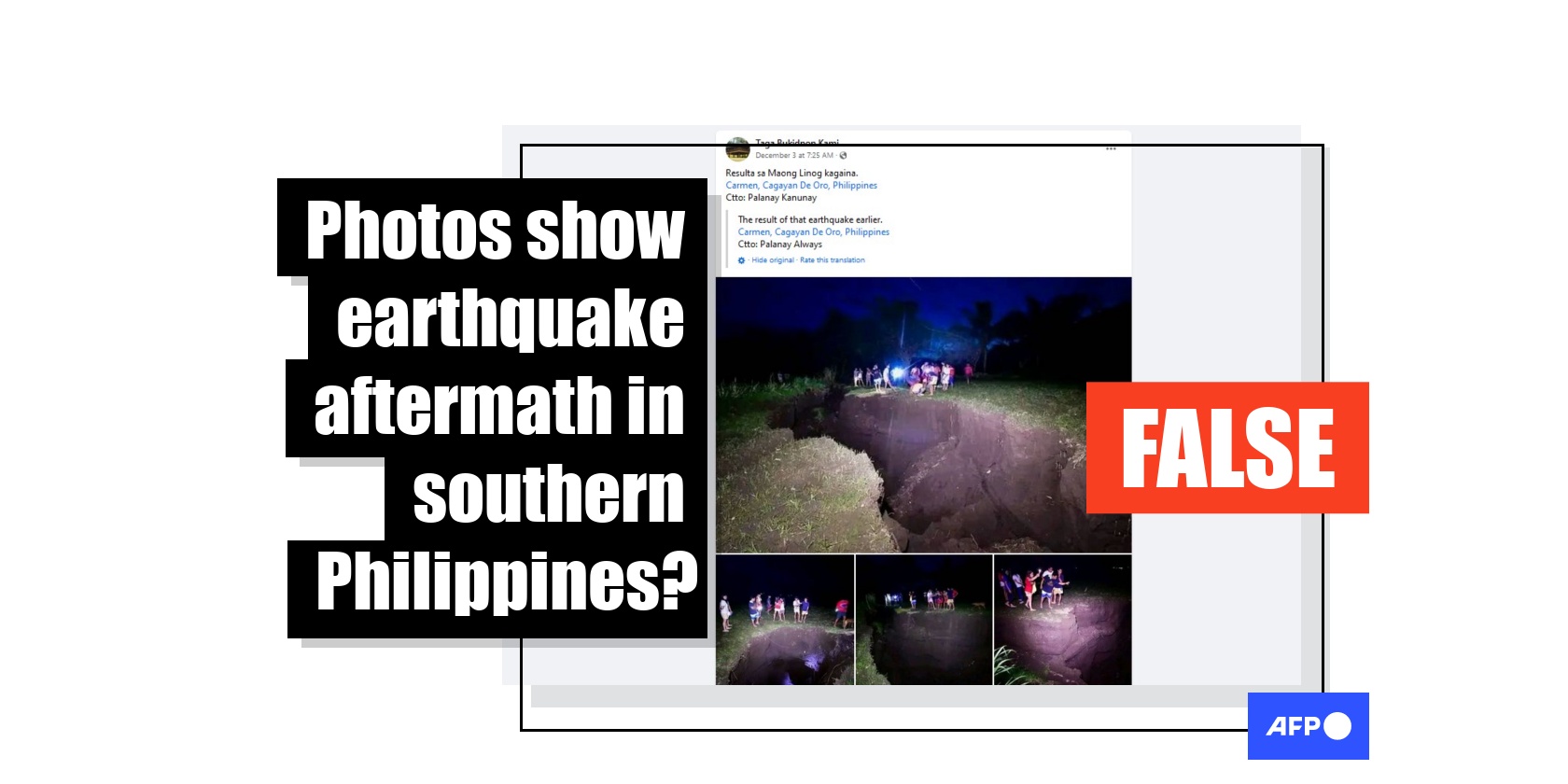
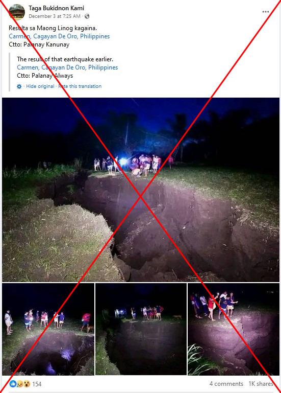
Facebook users claim four photos of people looking into a gaping split in the earth show devastation left by the massive quake, which struck off the east coast of Mindanao island.
"The result of the earthquake earlier. Carmen, Cagayan de Oro, Philippines," says one post from December 3 in Visayan, a language spoken in central and southern parts of the country.
Carmen is a district in the city of Cagayan de Oro, which lies about 200 kilometres from the epicentre of the quake (archived links here and here).

At least three people were killed and several others were injured when the earthquake took place, which also briefly triggered tsunami warnings. The area also saw a series of aftershocks exceeding 6.0 in magnitude.
The claim about the hole in the ground has been shared widely on Facebook including here and here.
But a reverse image search on Google coupled with keyword searches on Facebook found the pictures were taken three years earlier in a Philippine province more than a thousand kilometres away.
Ground fissures
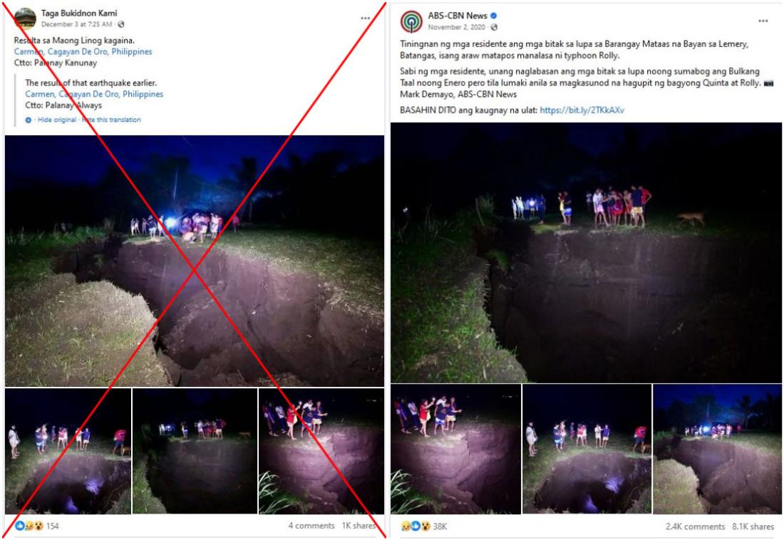
The photos were originally shared on Facebook by major Philippine broadcaster ABS-CBN on November 2, 2020 (archived link).
ABS-CBN's post says they were captured after Typhoon Goni, known in the Philippines as Rolly, barrelled across the north of the country that year.
"Residents stare at cracks in the ground in the district of Mataas na Bayan in Lemery city, Batangas province, a day after Typhoon Rolly struck," the post says in Tagalog.
ABS-CBN also debunked false claims about the photos, saying they were taken by a photojournalist named Mark Demayo (archived link).
Demayo told AFP he captured the images on November 2, 2020.
"We got there just after sunset, I was prepositioned in Batangas for Rolly's landfall," he said.
Below is a screenshot comparison between the false Facebook post (left) and ABS-CBN's post (right):

Multiple Philippine media outlets also featured photos of the split in the ground at the time, including GMA News, News 5 and state broadcaster PTV (archived links here, here and here).
The reports quote local authorities saying the cracks first appeared after the nearby Taal Volcano erupted in January, but they seemed to grow wider after typhoons including Rolly (Goni) hit the area.
The Philippine volcanology agency Phivolcs observed ground fissures in Mataas na Bayan days after Taal Volcano erupted in January 2020 (archived link).
Heavy rains from typhoons widened the cracks, science and technology secretary Renato Solidum, who at the time was Phivolcs chief, told GMA News.
Mataas na Bayan is more than 1,000 kilometres from Cagayan de Oro and was not affected by the December quake, according to a bulletin issued by Phivolcs (archived links here and here).
Disaster management authorities in Cagayan de Oro told AFP on December 13 no hole in the ground similar to the one shown in the photos emerged after the earthquake.
Only "isolated cracks" were found on a steel bridge after the tremor, according to a report by the local public works and highways agency (archived link).
Copyright © AFP 2017-2026. Any commercial use of this content requires a subscription. Click here to find out more.
Is there content that you would like AFP to fact-check? Get in touch.
Contact us
