False super typhoon warning sparks alarm in Philippines
- This article is more than two years old.
- Published on November 23, 2023 at 10:10
- 4 min read
- By Lucille SODIPE, AFP Philippines
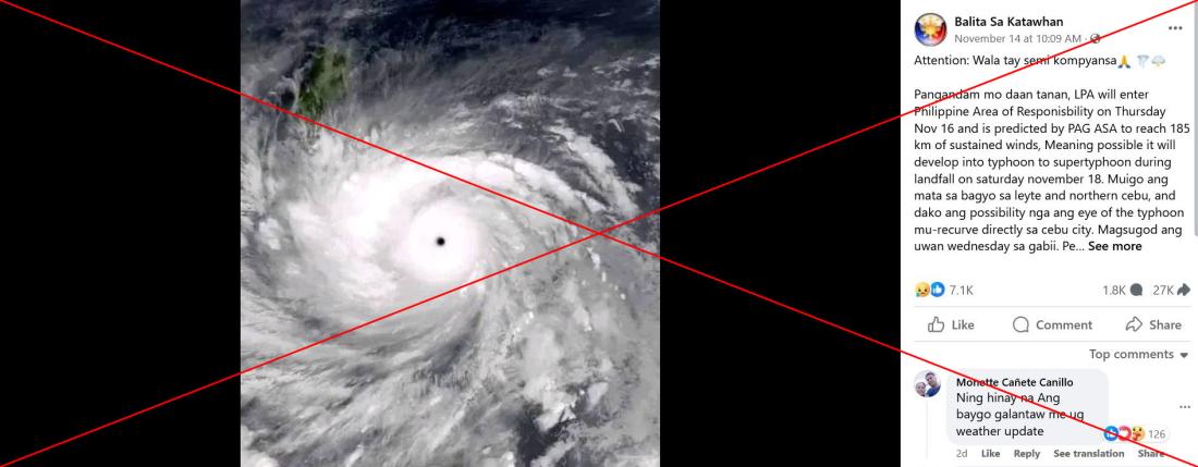
One Facebook post, which has been shared more than 27,000 times, warns people to be ready to evacuate.
"Possible it will develop into a typhoon or super typhoon during landfall on Saturday," says the post, which was published on November 14.
"Prepare yourself, LPA (low pressure area) will enter the Philippine Area of Responsibility on Thursday, November 16, and is predicted by PAGASA to reach 185km in sustained winds," it adds.
PAGASA is the national weather agency and the Philippine Area of Responsibility is the region it monitors.
The post was written in a mix of English and Visayan, which is spoken in the central Philippines. It claims the eye of the storm was forecast to pass over the central provinces of Cebu and Leyte.

Similar warnings were shared elsewhere on Facebook including here, here and here.
Social media users appeared to believe the claim.
"Thank you for the update. God, protect us," one said.
"God, help your children here on Earth, don't let us die," wrote another.
The Philippines is hit by an average of 20 major storms a year and scientists have warned that typhoons are becoming stronger due to human-induced climate change.
But weather agencies in the Philippines and overseas did not issue any warning about a super typhoon near the country in mid-November.
'No announcement'
PAGASA told AFP it did not issue any alert for a super typhoon in the period.
The US government's Climate Prediction Center also did not track any super typhoon around the Philippines during the week beginning November 13 (archived link). The centre regularly publishes a global forecast of weather hazards in the tropics.
The Hong Kong Observatory did not mention any super typhoon either. Keyword searches on both its Chinese and English accounts on X, formerly known as Twitter, found no related warning (archived links here and here).
"As of our latest official advisory, there is no announcement or prediction from PAGASA about a super typhoon entering the [Philippine Area of Responsibility] on November 18," said PAGASA weather services chief Jun Galang on November 16.
The Philippine bureau did issue an advisory about a "tropical depression" located near the Pacific nation of Palau, warning it could develop into a typhoon and hit the central Philippines. But there was no mention of a super typhoon.
Palau lies almost 1,000 kilometres east of the Philippines.
PAGASA issued three advisories about this weather system. The first on the morning of November 13 identified the tropical depression -- the first tier in a five-tier cyclone classification system based on wind strength (archived links here and here).
"This tropical cyclone may intensify over the TCA (Tropical Cyclone Advisory) region and reach typhoon category with peak intensity of 120km/h on Saturday. The possibility of further intensification prior to its close approach to Eastern Visayas is not ruled out," it said, referring to the central Philippines.
However, there was no mention of a super typhoon, and on November 14 PAGASA issued a final advisory saying the tropical depression had weakened to a low pressure area (archived link).
A super typhoon is classified in the Philippines as a storm with maximum wind speeds exceeding 185kph.
PAGASA weather specialist Daniel James Villamil said in a forecast four days later that "there is little chance it will develop into a storm in the coming days" (archived link).
No typhoon has hit the Philippine archipelago so far this November.
'Truly misleading'
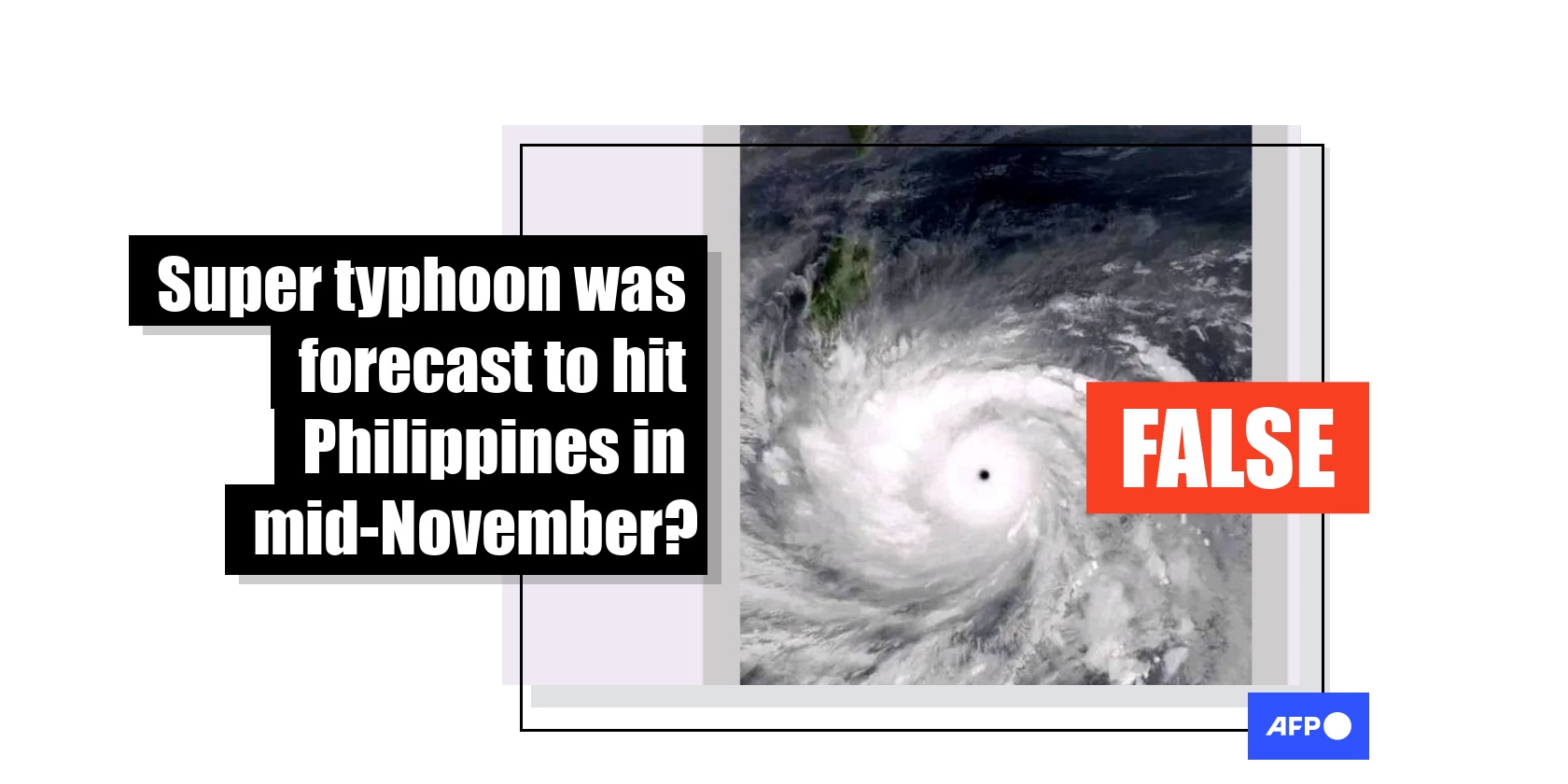
The satellite image with the Facebook post shows Super Typhoon Haiyan, known as Yolanda in the Philippines, hurtling towards the country in November 2013, another PAGASA specialist, Marco Ibañez, told AFP.
"The screenshot of the Facebook post you sent is truly misleading," he said on November 16. "That is a satellite image of Typhoon Haiyan/Yolanda."
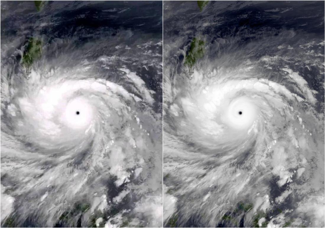
A reverse image search on Google found an identical photo posted to Wikipedia (archived link).
"Typhoon Haiyan at peak intensity and approaching the Philippines on November 7, 2013," reads a caption with the image. It is credited to US space agency NASA.
The same photo was also identified as Haiyan by the World History Archive, which is based in Britain (archived link).
Below is a screenshot of the image in the Facebook post (left) alongside the photo on Wikipedia (right):

Haiyan unleashed winds of up to 315 kilometres an hour (195 miles per hour) that flattened towns and cities across a 600-kilometre stretch of central islands in the Philippines.
About 6,300 people were killed and a decade later more than a thousand are still classed as missing.
AFP has previously debunked another weather warning regarding the Philippines.
Copyright © AFP 2017-2026. Any commercial use of this content requires a subscription. Click here to find out more.
Is there content that you would like AFP to fact-check? Get in touch.
Contact us
