
Video of Chinese plateau falsely linked to Turkey-Syria earthquake
- This article is more than two years old.
- Published on February 24, 2023 at 08:37
- 2 min read
- By AFP Thailand
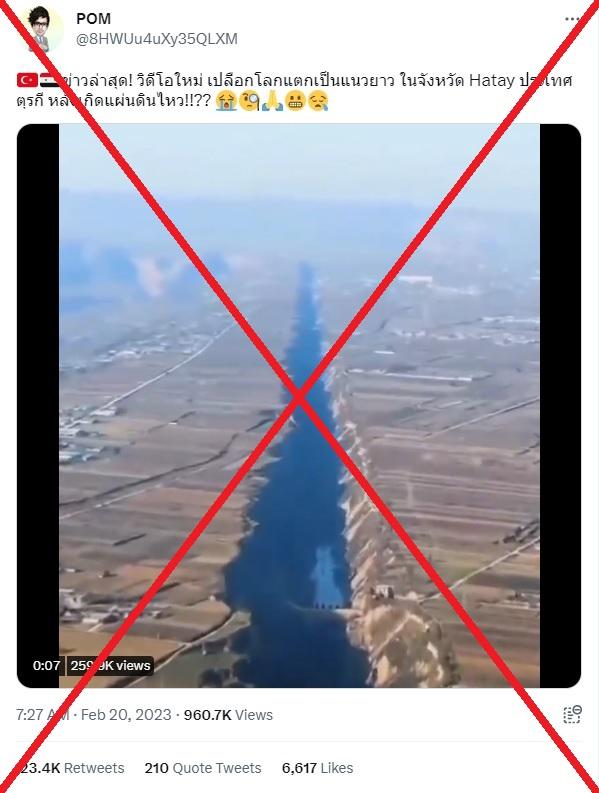
"Latest news! A new video shows the Earth's crust cracked in a long distance in Hatay province, Turkey, after the earthquake!!??" reads a Thai-language tweet posted on February 20.
The video, which has more than 260,000 views, shows deep ravines in landscape, with roads and buildings on either side.
An earthquake rocked Turkey's southern Hatay province and northern Syria on February 20, killing six people.
It came two weeks after a devastating 7.8-magnitude earthquake hit southeastern Turkey and neighbouring Syria on February 6, killing more than 45,000 people.
Large faultlines appeared in southern Turkey's Kahramanmaraş province, which was the epicentre of the quake.
Drone footage showing the ruptured landscape in the countryside was featured in reports by ITV and The Guardian.
The eight-second video was shared on Twitter in various languages, including English, French and Chinese, on Facebook in Thai and on VKontakte in Russian, with more than one million views combined.
China drone footage
A reverse image search followed by keyword searches on Google and Douyin found the scene in the video published on Douyin in December 2021 here and here.
Below is a screenshot comparison of the video clip in the false posts (left) and the video from Douyin (right):
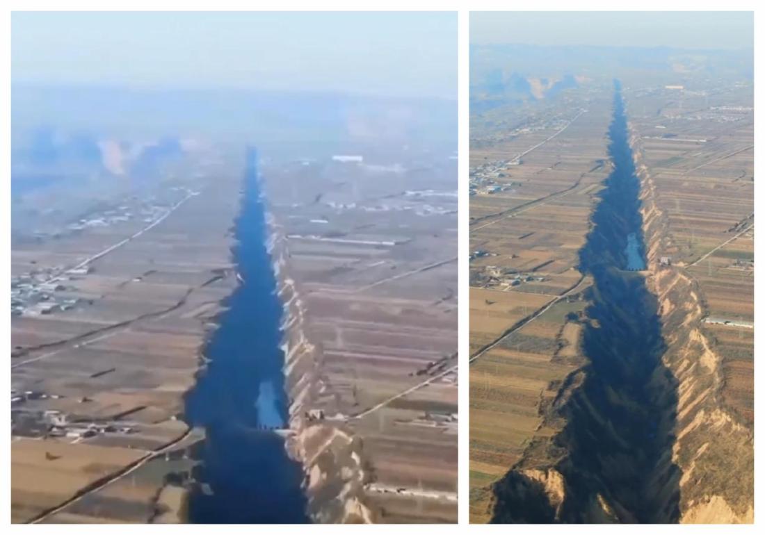
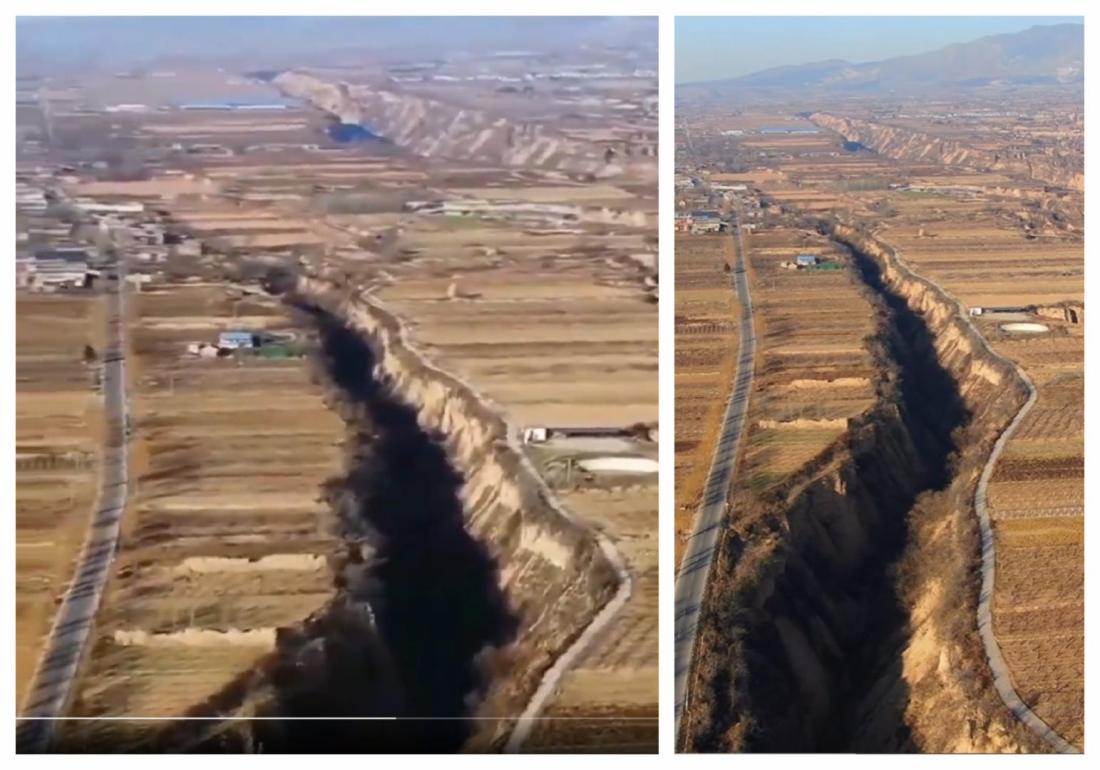
The videos were published by a Douyin user called "Aerial Photography Pinglu" -- referring to a county in Shanxi state -- which regularly uploads drone footage of mountainous areas.
The Douyin user told AFP the videos were filmed on the Loess Plateau, a highland area in north-central China covering some 400,000 square kilometers (150,000 square miles).
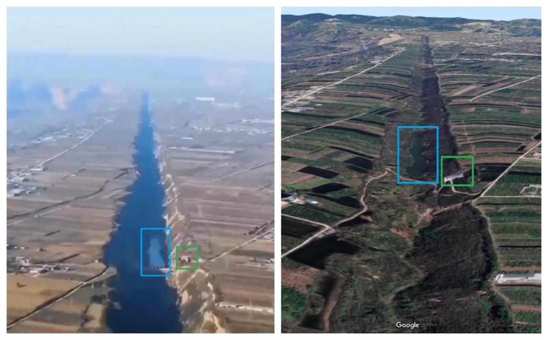
Below is a screenshot comparison between the misleading video (left) and Google Maps' globe view (right) with corresponding elements highlighted by AFP:
The Economic Daily, a state-owned newspaper in China, wrote in a 2015 report that there were up to "three thousand" fissures in Pinglu county, largely caused by soil erosion.
Copyright © AFP 2017-2026. Any commercial use of this content requires a subscription. Click here to find out more.
Is there content that you would like AFP to fact-check? Get in touch.
Contact us
