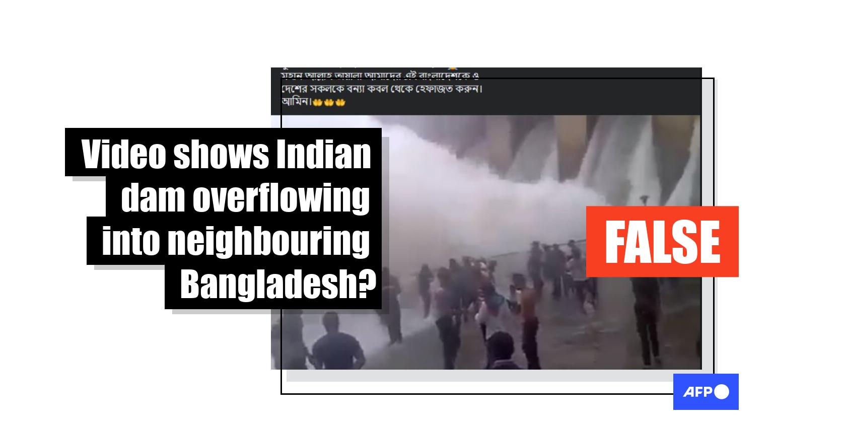
Video shows dam overflowing in southern India, not West Bengal
- This article is more than three years old.
- Published on July 6, 2022 at 14:37
- 2 min read
- By AFP Bangladesh
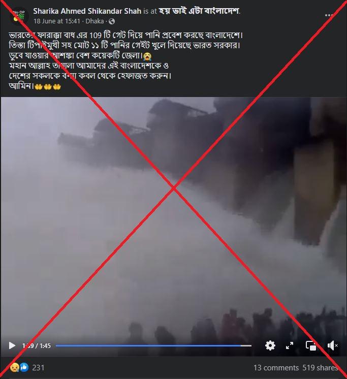
The clip was shared here on Facebook on June 18, 2022.
The post reads, "Water is entering Bangladesh through 109 gates of Farakka Dam in India.
"The Indian government has opened a total of 11 water gates, including the Teesta Tipaimukh. Several districts are at risk of drowning."
The one-minute 45-second video shows huge waves of water flowing from a dam while a group of onlookers stands nearby.

The Farakka Barrage was built across the Ganges river in the Indian state of West Bengal, about 18 kilometres (11 miles) from the northwest border of Bangladesh.
It was built in 1961 to divert an adequate quantity of water to the Bhagirathi-Hooghly river system.
In 1996, the governments of India and Bangladesh signed a treaty to share the water flow at Farakka from January 1 to May 31 every year for 30 years.
Relentless downpours in June 2022 caused widespread flooding and left more than four million people stranded in the northeastern region of Sylhet in Bangladesh, AFP reported here.
The same video was shared here and here on Facebook alongside a similar claim.
However, the claim is false.
People in the video can be heard speaking in the Kannada language, the native language of India's Karnataka state.
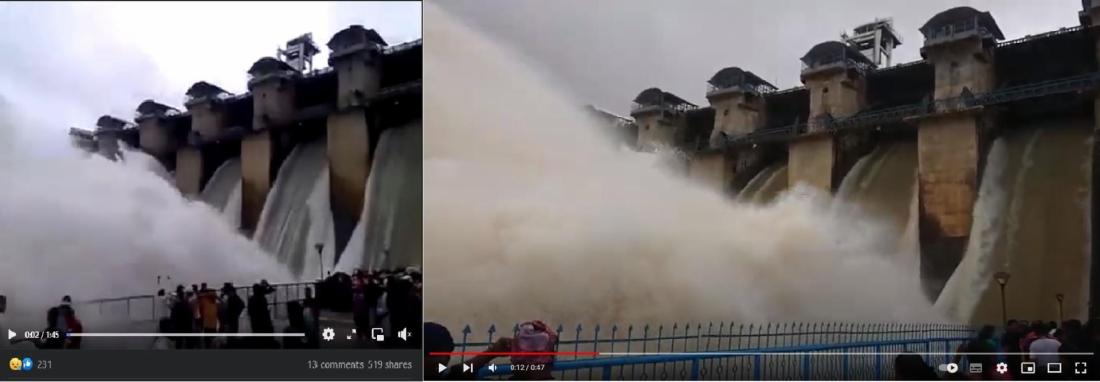
A reverse image search on Google found a similar, high-quality video posted on August 11, 2019 on a YouTube channel called "Karnataka Travel Diaries".
The title reads, "Hemavthi dam, Gorur."
The Gorur Dam is situated on the Hemavathi river in Hassan district in the southern Indian state of Karnataka. It is more than 2,300 kilometres (1,400 miles) from the Farakka Barge.
According to the Indian government's website, the Farakka Barrage is about 2,245 meters long, whereas the dam structure in the video appears much shorter.
Below is a screenshot comparison of the video in the misleading post (left) and the YouTube video (right):

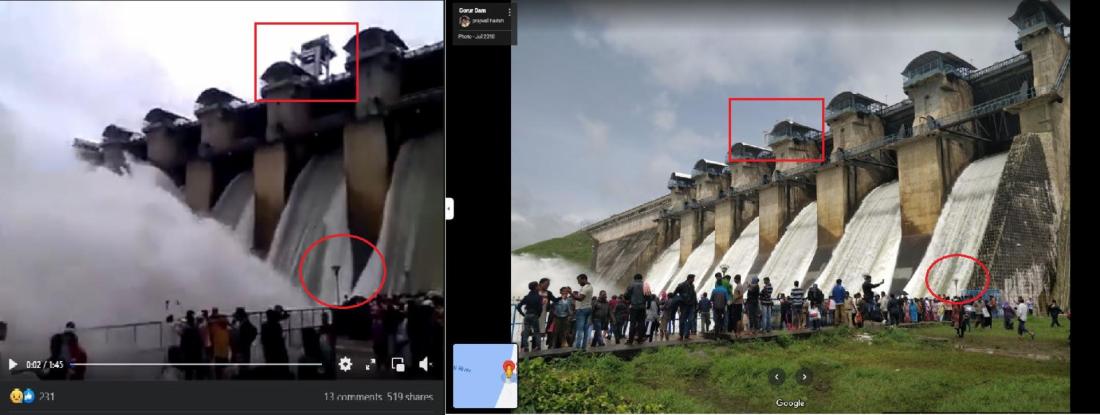
The dam in the video corresponds with images tagged at its location on Google Maps.
Below is a screenshot comparison of the video in the misleading post (left) and the image on Google Maps (right) with corresponding features highlighted by AFP:

Copyright © AFP 2017-2026. Any commercial use of this content requires a subscription. Click here to find out more.
Is there content that you would like AFP to fact-check? Get in touch.
Contact us
